What Is Site Analysis?
© architexturedesk
What Is The Purpose Of A Site Analysis?
Site analysis is crucial for designers to understand a project site. They examine aspects like location, size, topography, zoning, traffic, climate, and potential changes. Site analysis diagrams provide architects with data on sun and shade patterns, movement, land use, and public/private spaces. This helps designers create a design that integrates with external conditions. Site analysis benefits both designers and clients by ensuring financial feasibility.
How To Do Site Analysis?
Obtaining a high level of detail is crucial for a comprehensive site analysis. Designers need to consider the contextual aspects of the building or structure they are creating. It is important to understand how the construction will fit in with the surrounding space and how the space itself will impact the construction process. These factors are critical in conducting a thorough site analysis. To ensure an informed architectural site analysis, it is necessary to follow these three steps before starting construction.
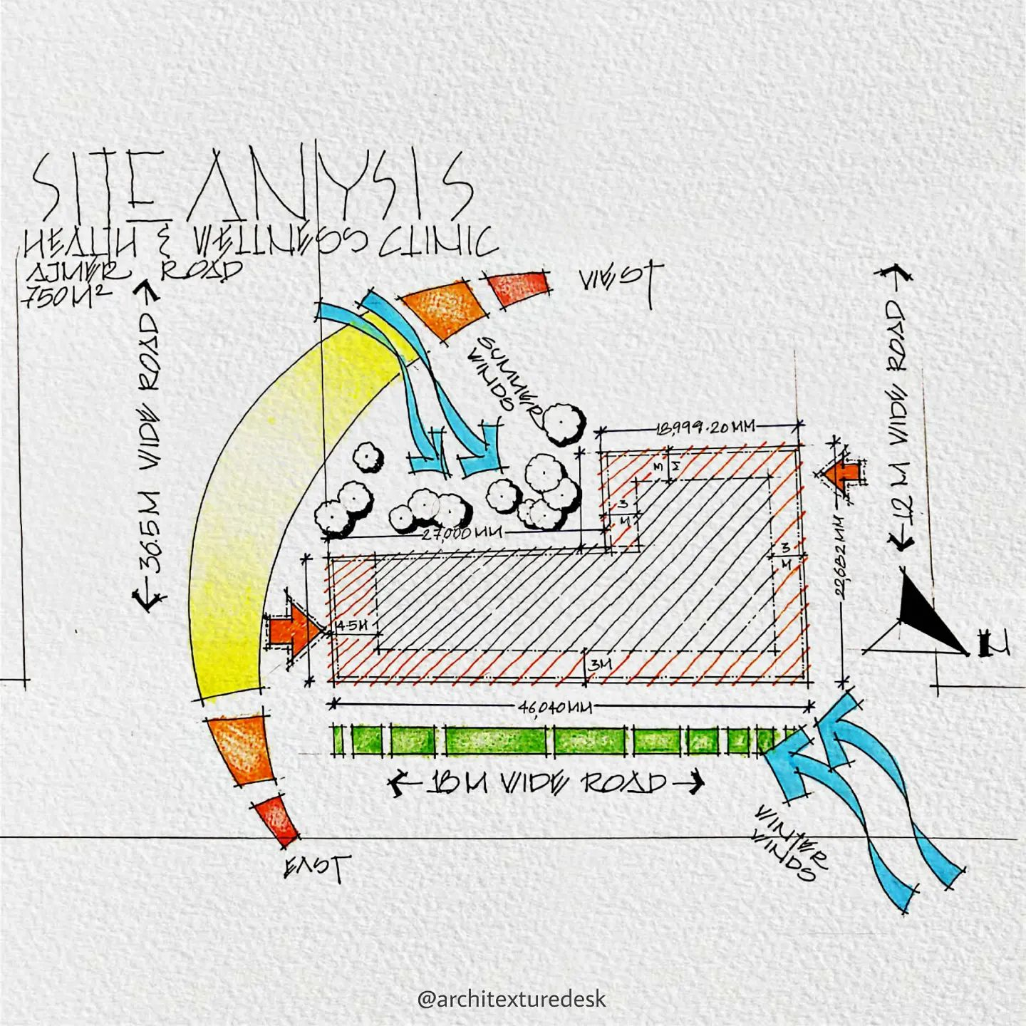
© roy_architecture
1. Research
When analyzing a site, look beyond property boundaries. Research the site’s physical condition and history. Use online tools to access relevant information and visit the site in person. Take notes, pictures, and measurements to assess size, parking, accessibility, public transportation, and noise level. Gathering comprehensive information is key for a thorough analysis.
2. Analysis
After a site visit, analyze findings by reviewing and comparing information, using visual aids like diagrams. Consider project goals and site characteristics.
3. Synthesis
The information you gather and conclusions you reach during site analysis will provide context for your project. Data collection is important, but it must be transcribed into relevant content. Analysis will reveal which site conditions influence design parameters. Combine your research, observations, and limitations to begin schematic design and programming.
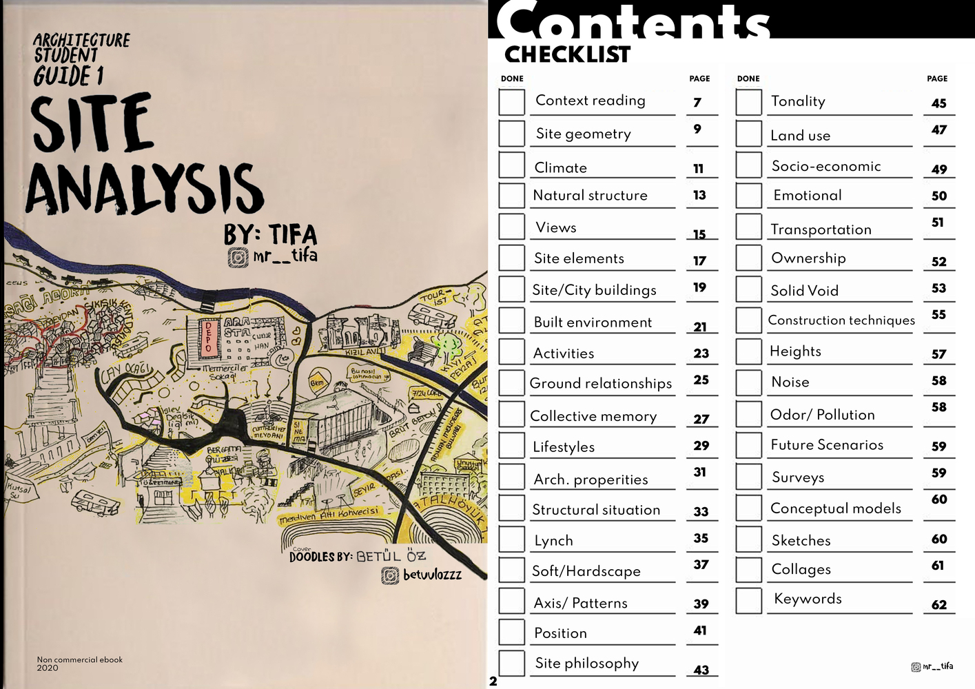
Site Analysis Ebook cover and contents
Site Analysis Checklist Of Data Types
Conducting thorough research and performing a comprehensive site analysis is of utmost importance. Inadequate site analysis may result in costly or difficult problems that could be hard to address during later stages of the design or construction process. During a site analysis, there are three types of data that should be collected and analyzed. We will discuss each of these data types separately. The best analysis considers all three. These include:
Mega , Macro, Micro
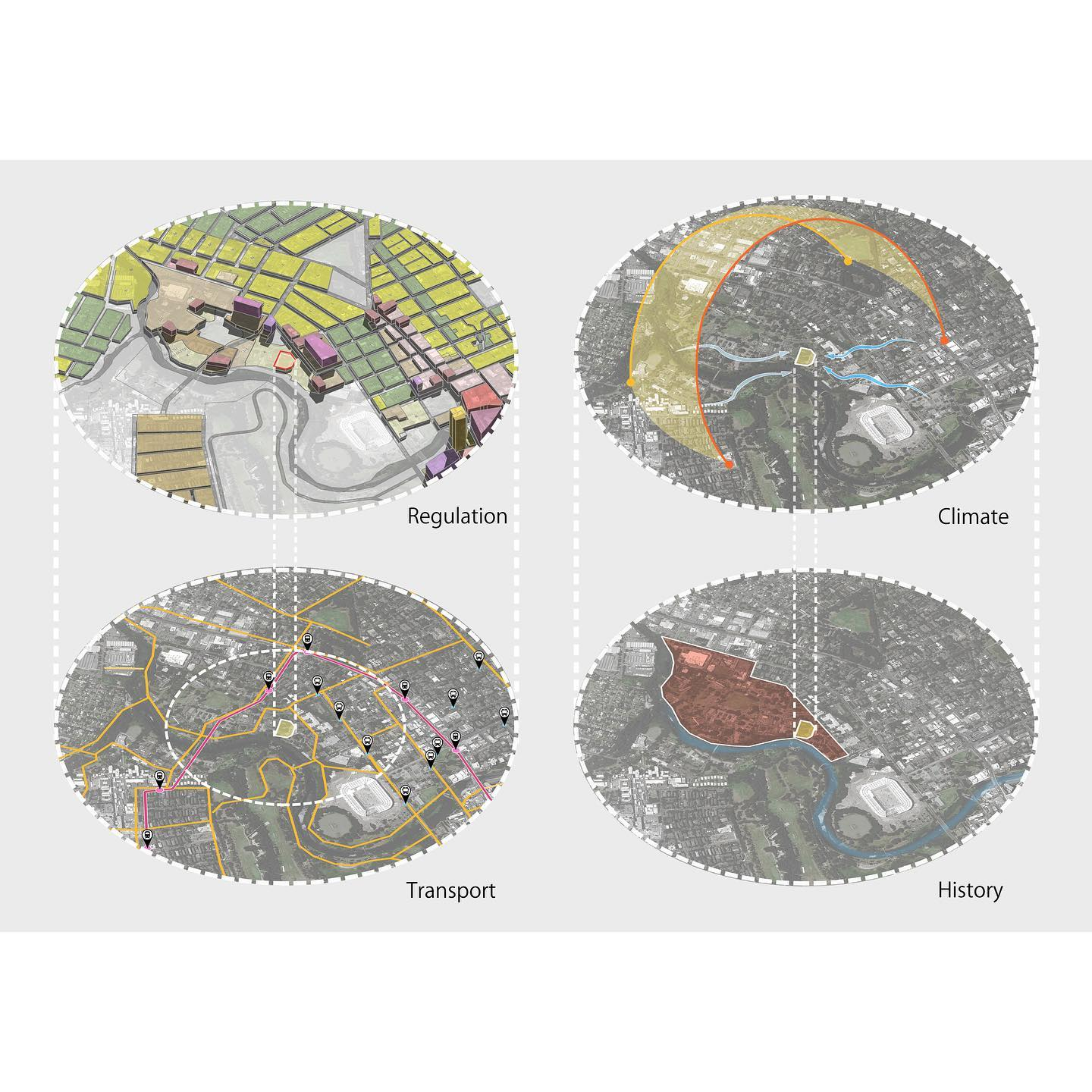
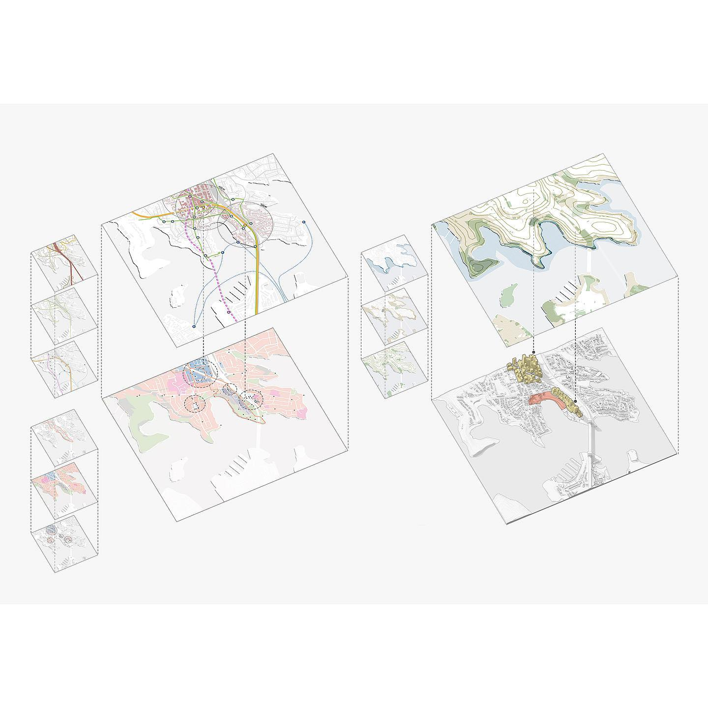
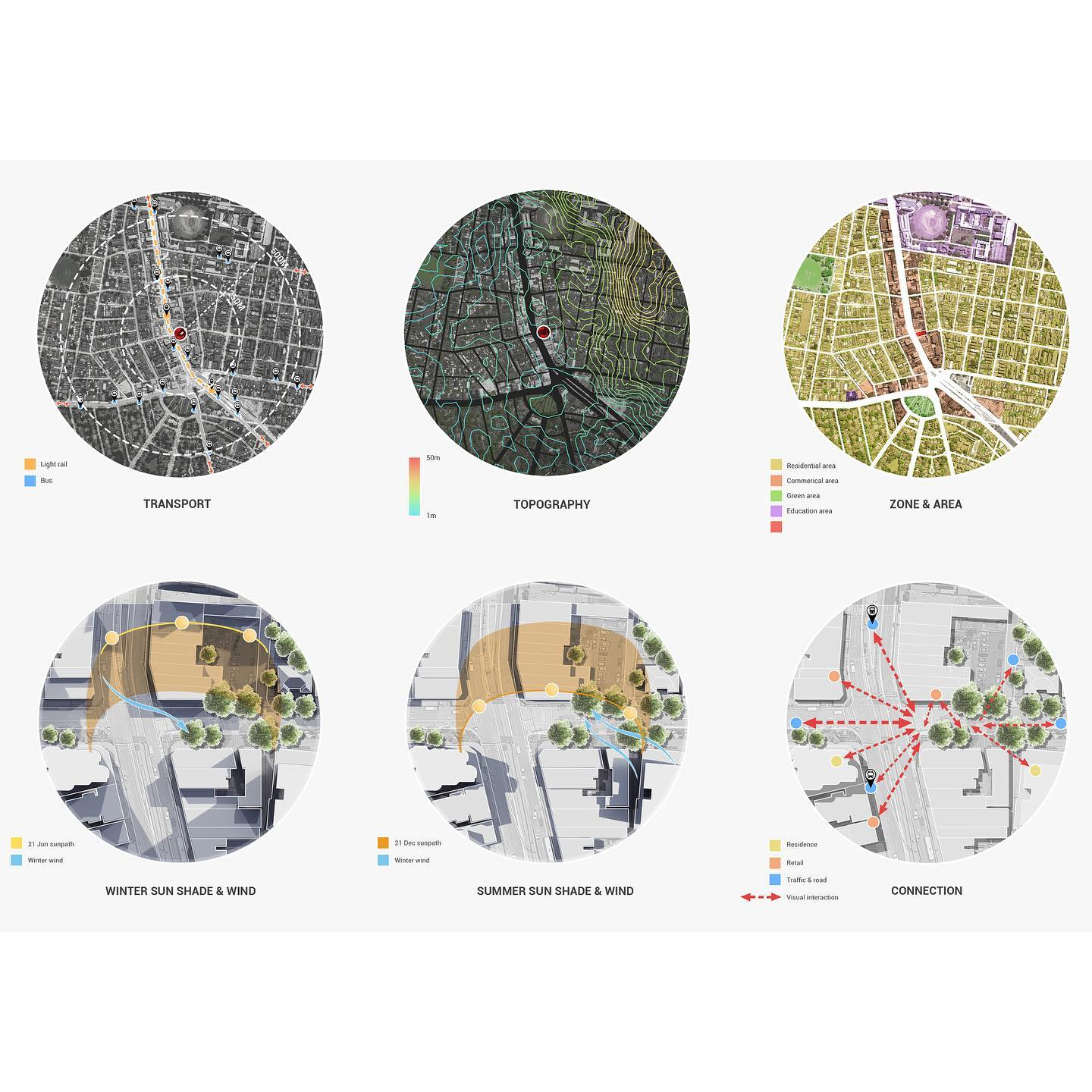
When conducting a site analysis, it is important to take a strategic approach that involves examining both objective and subjective data across three distinct scales.

© Taghreed Hawawsheh
Objective Or Hard Data
01 | Location
Site Survey: Acquire the site survey document and extract meaningful information, such as measurements and other significant details.
Aerial Photographs And Maps: Gather historical and up-to-date aerial photographs and maps of the site, suburb, and surrounding areas. Analyze these documents to identify noteworthy information related to the site.
Site Boundary: Locate and verify the site’s boundaries, ensuring they are clearly defined and accurate on the physical location.
Dimensions: Ascertain the size, measurements, angles, shape, and proportions (including radii) of the site.
© roy_architecture
2 | Authorities
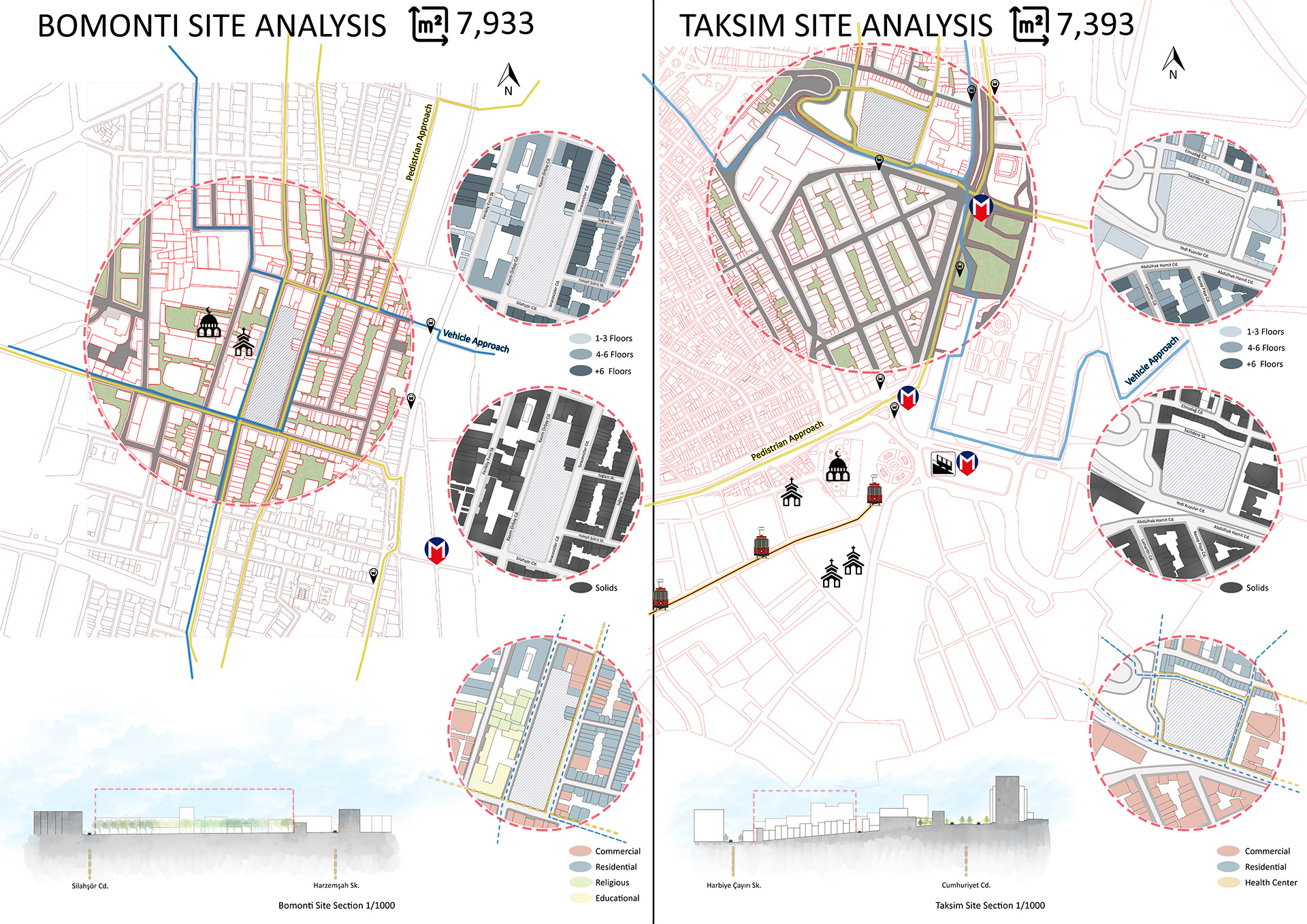
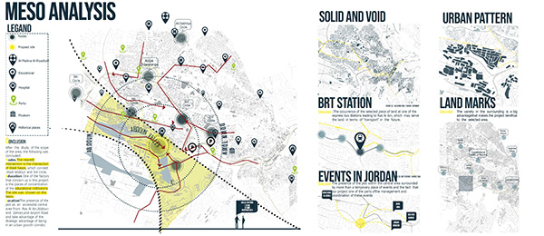
3 | Adjacent Structures And Conditions
Provide information about the physical conditions that exist around all the boundaries of the site.
Land Uses Explore neighboring land uses, structures and spaces.
Adjacent Artificial Conditions Examine human-made conditions adjacent to the site, including private properties and public areas such as footpaths, entrances, and roadways.
Distance To ensure proper spatial planning, it is important to calculate the distances between the site and its neighboring sites, spaces, and structures.
Heights It is important to evaluate the various heights of the adjacent sites, spaces, and structures.
Vernacular Consider the vernacular, styles, and distinct features of neighboring sites and structures.
© Taghreed Hawawsheh
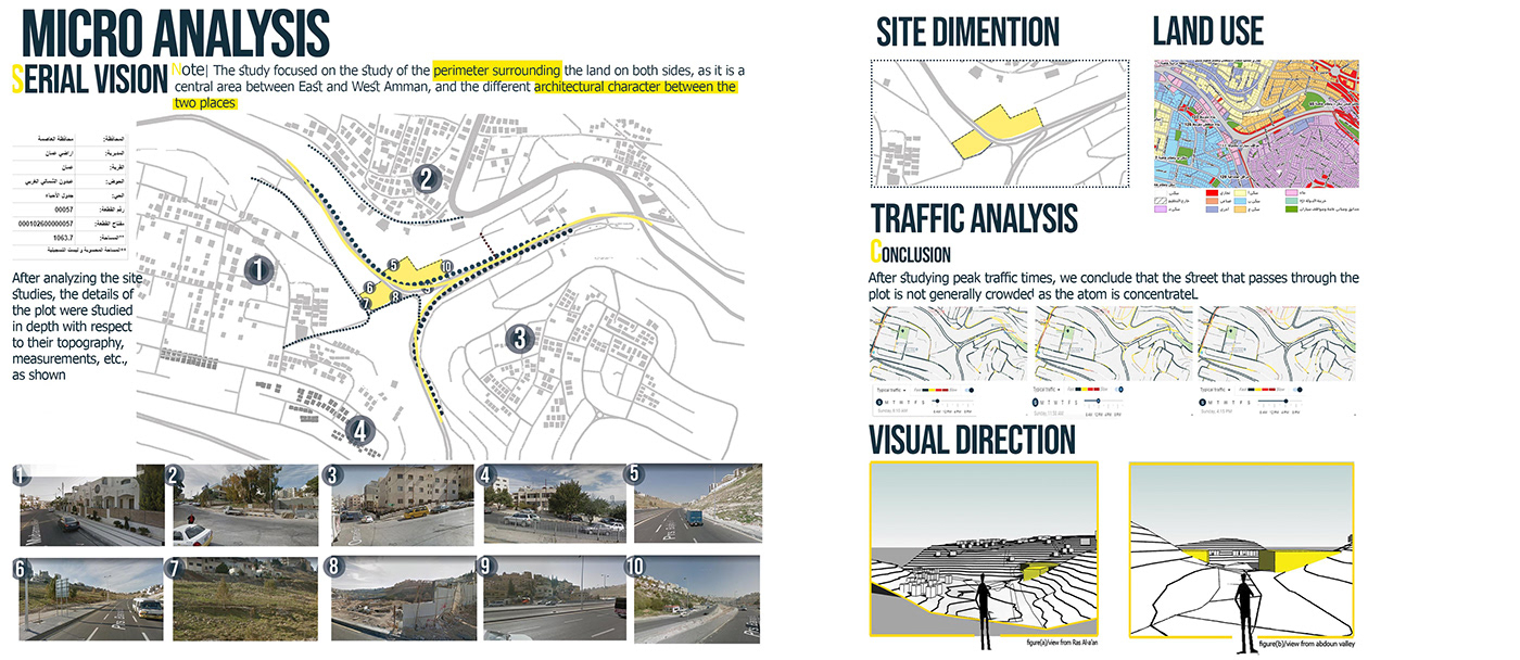
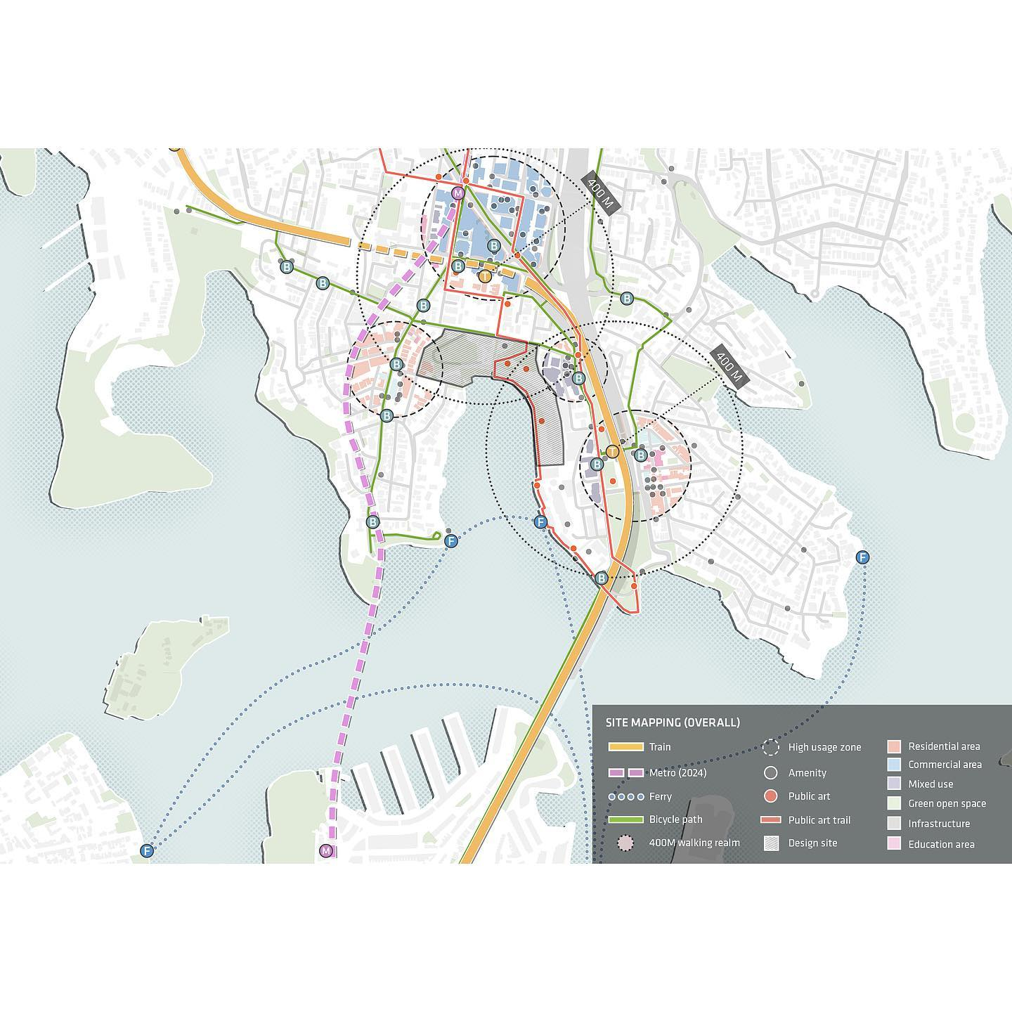
4 | Streetscapes, Elevations And Sections
Comprehensive depiction of vertical conditions in the area including streetscapes, elevations, and sections.
Streetscape Panoramas Of The Site Utilize panoramic photographs to provide a visual representation of the site and its surroundings, showcasing the area’s character, form, and materials.
Street And Site Elevations Please display the elevation at the boundary and/or center of the street, including the levels, boundaries, and permitted building envelope as defined by authorities. In addition, please show any vegetation, existing structures, and adjacent conditions, such as building and structure height and distances.
Site Sections Present cross-sectional views that illustrate levels, boundaries, vegetation, existing structures, and adjacent conditions including building and structure height and distances to provide a c6omprehensive understanding of the site’s characteristics.
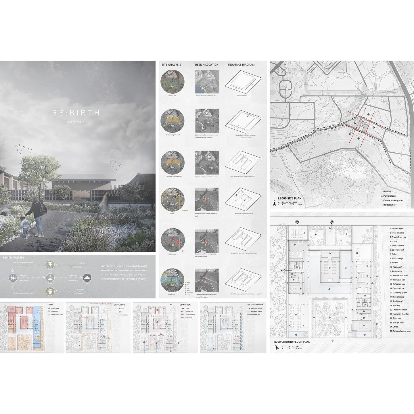
© roy_architecture
© roy_architecture
© Courtesy of SketchUp
© Wei Jun
© roy_architecture
Subjective Or Soft Data
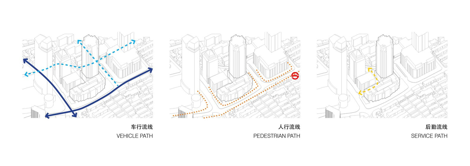
1 | Access and movement
The site’s entry points, exits, and pathways and their interactions.
People: These are the footpaths used by pedestrians, including entry, exit, and circulation paths within and around the site.
Vehicles: Refer to cars, trucks, bicycles, skateboards, or other means of transportation on the site, including the hierarchy of external and adjacent roads, as well as entry, exit, and circulation paths.
Public Transport Links: The site’s proximity to bus stops, train stations, taxi stands, tram stops, cycle lanes, and other transportation options, along with their routes, should be considered.
© roy_architecture
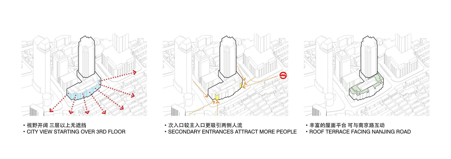
2 | Views
Refer to the visibility of a location and can be assessed by analyzing the surrounding areas and conducting walks.
Views In: Evaluate nearby perspectives and longer views from high points. Consider varying heights and identify potential viewing locations to test feasibility.
Views Out: Evaluate the site’s views of the surrounding environment, considering short-range and long-range perspectives, different elevations, and broader surroundings.
3 | Privacy
The act of keeping information, activities, or individuals hidden from others is privacy.
© WASEM B. HELLES
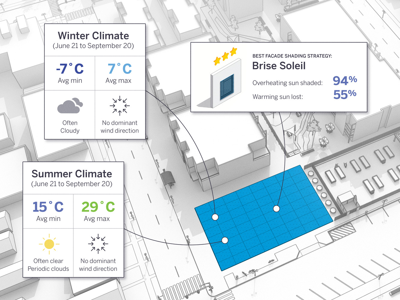
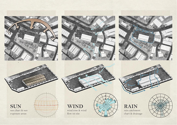
4 | Sound And Noise
The surrounding conditions, site’s state, and planned development produce auditory elements. Noise impact assessment – Identify external noise sources, consider wind pattern variations, and locate areas requiring internal noise protection measures.
5 | Smells
The scents – fragrances and odors released by the environment, current state of the location, and proposed development.
Smells In: Identify odors from outside, consider wind patterns, and protect site from internal odors.
Smells Out: Assess potential odors generated by the site, consider wind impact, and identify need for odor mitigation measures.
Site analysis is a crucial stage in the design process. It provides inspiration and guidance for developing concepts, making informed decisions, and discovering new design possibilities. Embrace it as an opportunity to ignite your interest and enthusiasm throughout the design process. Approach site analysis as an opportunity to consider each site’s specific needs. Use the checklist to determine which aspects are most significant. Focus on areas requiring thorough investigation and the aspects that will have the greatest impact on your design.
Mariam Abady is a dedicated editor at Arch2O, bringing a passion for sustainable and adaptive architectural practices. Based in Alexandria, she has contributed over 110 thoughtfully curated articles since joining in October 2023, showcasing her depth across cultural, educational, eco‑friendly, and urban infrastructure projects . With a background as a BIM engineer and architect, Mariam skillfully enhances the platform’s visual and thematic cohesion, staying attuned to emerging trends in lighting, material innovation, and urban design. Her editorial voice combines technical insight with creative storytelling, enriching Arch2O’s architectural discourse.