We have all been caught in the situation of being lost in unfamiliar places. How do we feel at that moment? Are we lost, intimidated, flustered, or suddenly running late? Do we have tunnel vision searching for resources or knowledgeable people directing us where to go? Then, a sigh of relief occurs as we stumble upon a wayfinding signage display (Kreik, 2013).
Origin of Wayfinding
Throughout history, humanity has always needed direction to indicate its origins and destinations, whether to return to its shelters or suggest a specific hunting route. The need for signs and wayfinding devices has always been present as long as spatial activities occur (i.e., always). Humans have used symbols and markers for thousands of years, but the process has evolved from a simple cave and wall drawings to more complex signs. Human wayfinding expanded with the evolution of cities and urban environments, and more efficient ways were created to direct people through more complex environments.
A 1000-year-old petroglyph in Utah. ©Ancient Origins
Changes in Style
The role of wayfinding devices doesn’t stop at directing people; it also characterizes a place and gives it an identity. Architects and planners began to call upon artists to help make signs and wall posts more aesthetic. The first to coin the term “wayfinding” was Kevin Lynch in his book The Image of the City (1960). It was a recognizable contribution to the profession about how people understand and interact with the surrounding environmentز

Medieval Europe was the birthplace of street signs. ©Alamy
What is Wayfinding?
You are here, but how do you know where here is? Municipal wayfinding systems direct visitors to destinations and serve as a teaching tool that educates visitors on the urban environment’s boundaries, destinations, and key features. This creates a “legible city” where identification elements support the overall urban structure and experience.
Kevin Lynch developed the legible city concept and suggested that all cities have a specific vocabulary that residents and visitors can “read” in the streets, landmarks, nodal areas, and unique districts. Designers discovered that by utilizing a system of gateways, signage, and streetscape elements, they could enhance the legibility of the respective city.
Today, the Lynch method of testing legibility through personal cognitive maps has shown the effectiveness of successful municipal wayfinding systems. London, England, has the world’s most extensive municipal wayfinding system, referred to as a “Legible City.”
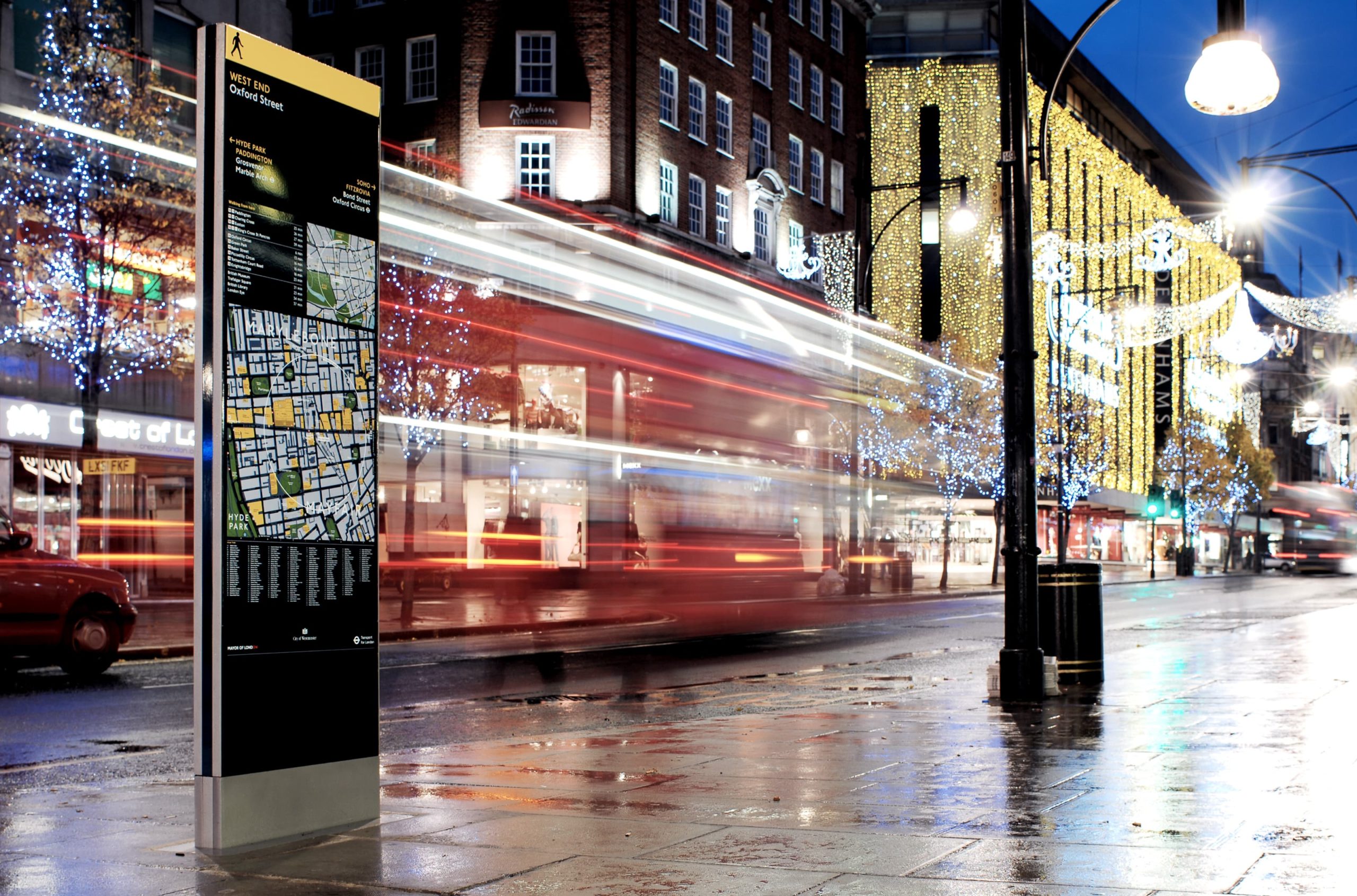
Legible London. ©Applied Information Group
Wayfinding is typically represented in an iconic structure that combines the work of planners, graphic designers, and architects through cartography. These structures are commonly found on campuses, in airports, or along streetscapes. Over the years, navigation principles and techniques have evolved in conjunction with advancing environments. Trends are shifting from traditional graphic methods to modern approaches, including advanced technology (Kreik, 2013).
Successful Wayfinding Principles
Wayfinding systems mean different things to different people based on their experiences. It can be experienced on a highway, in a park, or a pedestrian mall. In another way, wayfinding is found in public or private landscapes and interiors. It helps users to understand their surroundings better. A successful pathfinding system in urban areas has many moving parts that fit together.
To structure how all these elements work, looking at the individual elements as a series of layers a visitor encounters when experiencing an urban environment is essential. This encounter begins at the vehicular edges of the region and continues into downtown. Finally, it culminates in pedestrian main streets and destinations. While all these layers of experience do not need to be linked through design, successful systems utilize familiar design cues, including color, topography, shape, logo, material, and terminology.
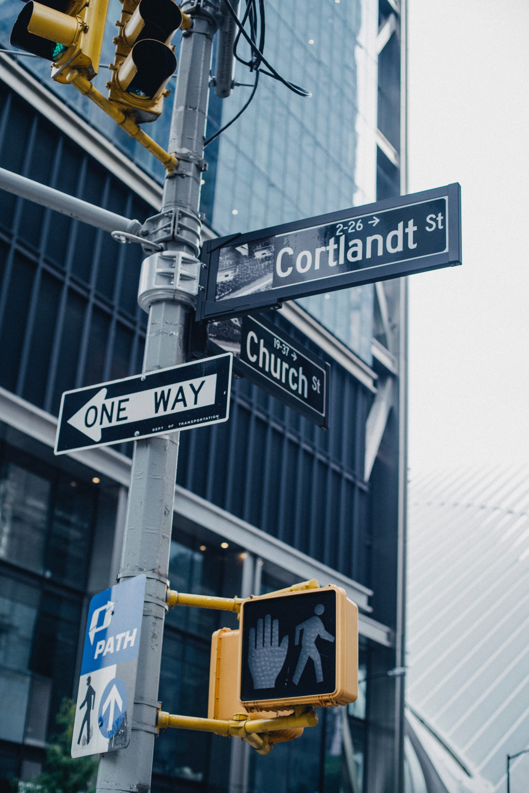
Photo by Ono Kosuki
These signage structures allow people to digest and comprehend any given environment quickly. Conveying clear direction can be a feat, and wayfinding will enable designers to orchestrate navigational experiences. One of the significant roles of these signage systems is to turn the visiting experience into a pleasant one, especially for those unfamiliar with the environment.
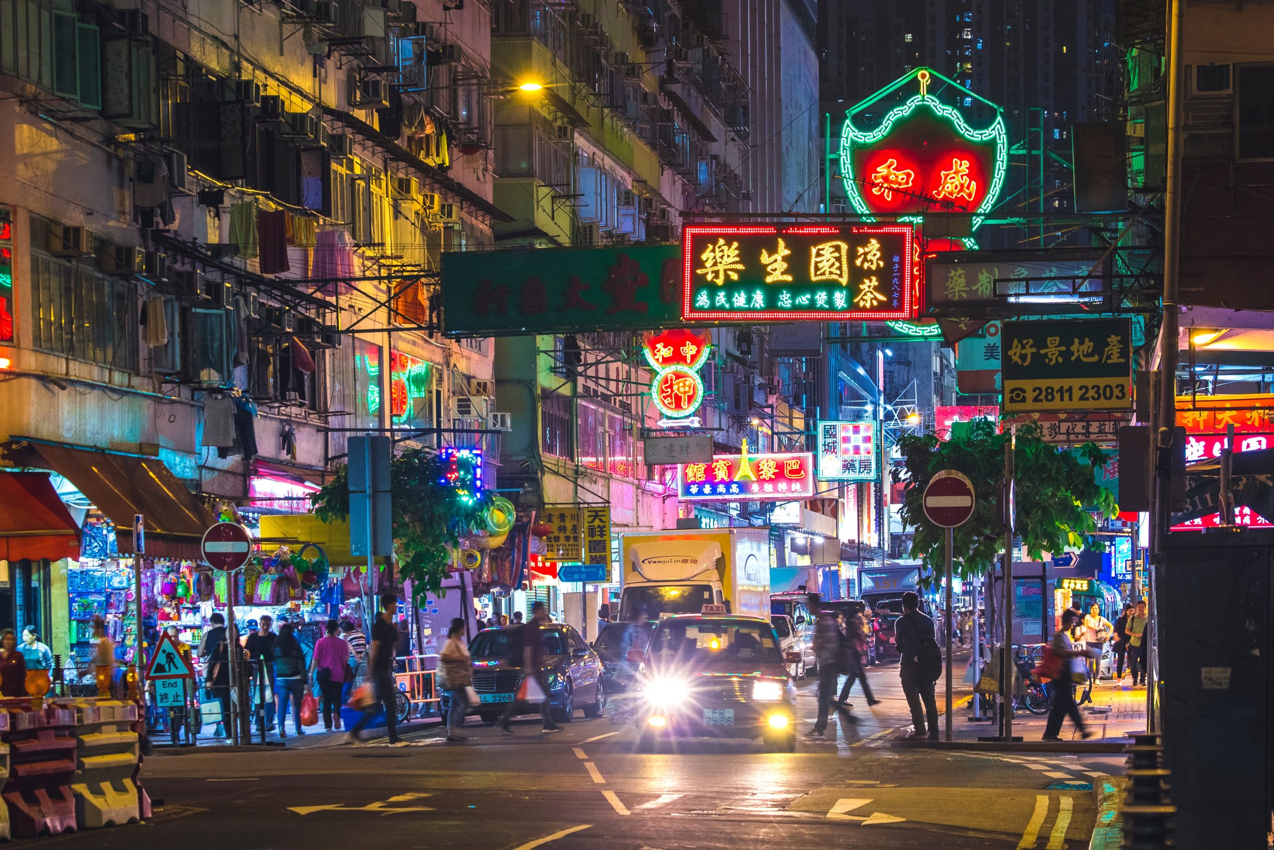
Therefore, it is crucial to know when signage systems are needed. Here are some reasons we use signs: the complexity of new cities, their vast expansions, the transit systems that appeared with the modern-age ease of mobility, the evolution of the tourism industry, and simply the lack of information available to users within the urban space.
First, for a pathfinding system design to be effective, it should be regarded as a separate entity but function as an integrated part of the environment. Second, designers should understand the navigation principles. A graphic standard should be set based on guidelines addressing style, size of characters, uniform colors, shape standards functions, and consistent placement of signs (Gibson, 2009).
©Jimmy Chan
One of the most renowned wayfinding precedents is the work of Massimo Vignelli, creator of NYC’s Metropolitan Transportation Authority (MTA) subway signage and mapping. Vignelli has guided billions of subway riders via his largely bolded Helvetic typography and sharp colors presented with precise shapes and arrows.
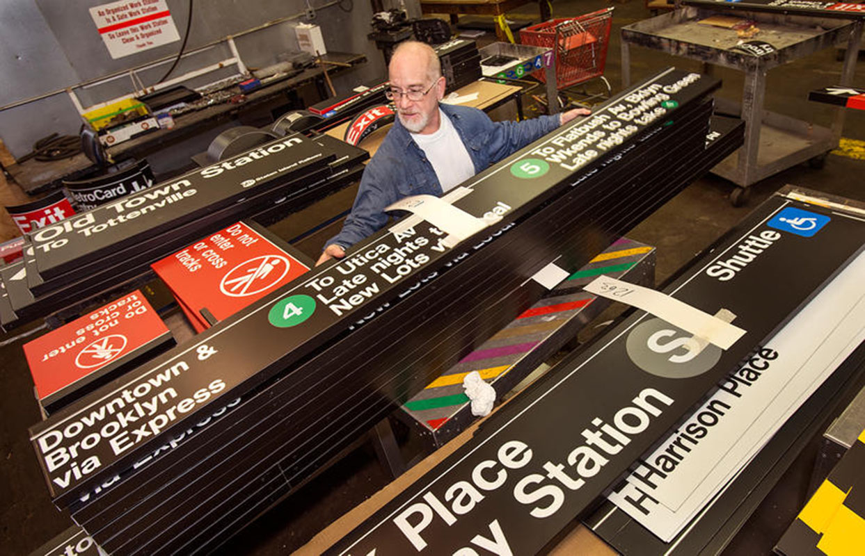
©MTA Flickr
F1RSTDESIGN created another example of pathfinding for Zollverein Park in Essen, Germany. Their graphic design pushed navigating further by transforming a typical site map into a three-dimensional model. Symbols and text on the model act as a preview for signs and indicators that users will see as they travel through the industrial landscape. This approach allows users to study and interpret a site from any angle. The model also translates the scale of the built environment, which is often overlooked when reading two-dimensional maps.
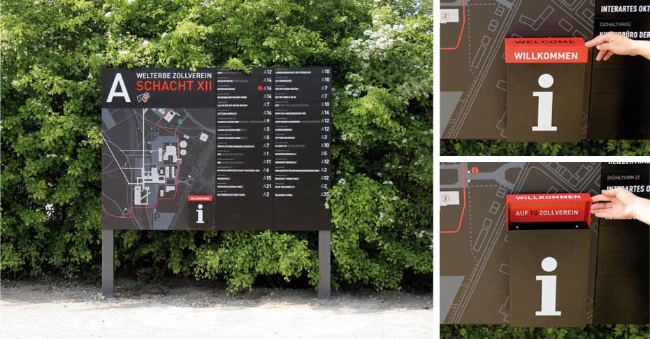
©F1RSTDESIGN
Technological Systems in Wayfinding
Nowadays, pathfinding systems do not solely rely on static signage systems like physical elements present in the landscape. Electronic and dynamic media are becoming very valuable as wayfinding tools. The advantage of this type of media is that it can be easily updated according to the changes in the surrounding environment. Today’s way people interact with global positioning systems (GPS) via smartphones is among the latest navigating examples.
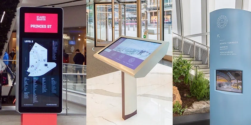
Digital Wayfinding Signage. ©The Velvet Principle.
Final Thoughts
In conclusion, the wayfinding experience in the urban space is influenced by various aspects present in the environment. These aspects vary between cognitive, physical, and virtual. The problem is that traditional wayfinding systems do not suffice alone in forming a place’s image and helping people navigate it. However, with the difference in individual potentials, a need for personalized or customized wayfinding systems on a portable device has become urgent.
Today, visitors plan their journey and indicate where they want to go and how to reach their destinations, even before visiting. Consequently, the role of designers in the wayfinding sub-field is to use these aspects to foster spatial information presented to the visitor. This information can be physically present in the environment or as additional aiding tools such as signs, Personal Digital Assistants (PDA), or virtual systems. In this way, users will understand their surroundings more clearly through new wayfinding strategies.
Riham Nady Faragallah is a Professor of Architectural Engineering at Pharos University in Alexandria, Egypt. With a BFA from Alexandria University and a Ph.D. earned in 2013, she has extensive experience teaching architectural design, environmental studies, urban design, and technical systems. Riham’s research and writing span urbanism, sustainability, informal settlements, and low-energy systems, with numerous publications and conference presentations . As an assistant editor at Arch2O, she contributed insightful articles on urban design and sustainability in architectural journals, advocating that architecture is "the art of the public." Her editorial work is informed by her academic rigor and deep engagement with environmental and public urban spaces, enhancing Arch2O’s discourse on sustainable urbanism.