Courtesy of TREDJE NATUR
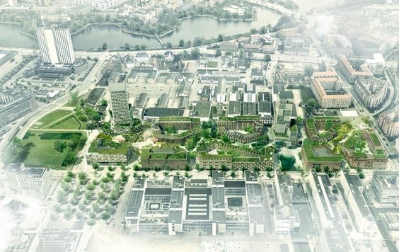
The property owner would like to create a new, attractive neighborhood on ‘Faste Batteri’ because of its central location in Copenhagen. The vision for the masterplan is to create a dense, green and well-structured neighborhood, with a building typology that is a reinterpretation of the classic Copenhagen block house, along with two high- rises acting as landmarks. The plan is structured around the green corridor as a connecting element. The property owner would like to work with different building typologies and modern community types in the project.
“District by district, we try to adjust the local area plans to reach a smaller scale, create more quality in the urban spaces and focus on the green, so we not just get architectural landmarks, but something that works for those who live and visit here. It is, after all, the Copenhagener’s city,” says Morten Kabell, environmental and engineering Mayor of Copenhagen.
Courtesy of TREDJE NATUR
CITY LIFE AND SPACES
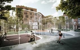
The zoning plan emphasizes the importance of the future of the area and it’s integration into the city, that can offer the local residents, users and visitors a unique, diverse neighborhood that focuses on a liveable city life and green urban spaces. The main infrastructural concept is a central, green public park that can be used for recreational purposes and will contain two future bicycle connections, ‘the Amager Route’ and the ‘Ørestad Route’. It will also function as a cloud burst and retainment area, according to the Municipality of Copenhagen’s stormwater management plans. The fortification at ‘Faste Batteri’ is a historical conservation area and will be re established and used as an urban park. The area is therefore an important part of the Municipality of Copenhagen’s goals for climate, city life, and a green and blue capital city, and to connect the city areas together.
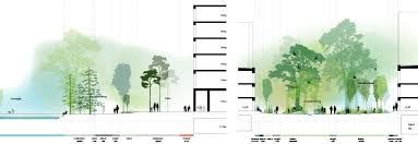
The buildings are divided into 8 blocks, which are based on the characteristics of the adjacent neighborhoods and are placed along the central green linear park. Each block has varying heights from 3 to 4 stories towards the linear park and 8 stories towards the street. The residential buildings will contain different types of residential typologies, including row houses, townhouses, apartments and penthouses. The zoning plan allows for small residential buildings, student housing, and special housing forms, where the community space around the residency is increased. In addition to the 8 housing blocks, the zoning plan allows for two high-rise buildings, 99 meters and 86 meters tall. Restrictions for the high-rises and their placement is based on the competition, held in the fall of 2014, and outlines the requirements for two landmark buildings in the plan.
The overall concept of the plan, the green linear park, should be formed as a clear green park with nature qualities that can contribute to ‘Green Strategy’ goals for Copenhagen, including biodiversity. There are also requirements in the zoning plan about stormwater management and green facades. The central green corridor connect ‘Amager Route’ and the ‘Ørestads Route’, which support the municipal vision for ‘Community in Copenhagen’.
Based on the results of the Municipality of Copenhagen’s sustainability tool, the building contractor has obtained a precertification for DGNB for the masterplan and the whole ‘Faste Batteri’ area. DGBN certification rates the life cycle of a neighborhood in a holistic and flexible way and looks at a neighborhood’s overall sustainability abilities.
Courtesy of TREDJE NATUR
Project Info:
Responsible Partner: Ole Schrøder
Design Team: Sofie Mandrup Andreassen, Johan Kure, Anna Sissela Michalsdottor, Helen Shuyang Chen, Karolina Julia Pajnowska, Max Moriyama, Michael Vestergaard Thomsen
Location: Amager, Copenhagen
Client: The Bach Group and Copenhagen Municipality
Team: Arkitema, Entasis and Polyform
Project Period: 2015
Built floor area: 125.000 m2
Plot density: 175 %
Open areas: 47.000 m2
Responsibility: Masterplan, climate, urbanity and nature
Type: Commission
Status: Ongoing