

Sustainable urban planning is the practice of shaping how a city grows, moves and uses land so that it meets the needs of today’s residents without exhausting the resources, climate and ecosystems that future residents will depend on. In practice it means compact, mixed-use neighbourhoods; streets designed for walking, cycling and public transport before cars; green and blue infrastructure that cools the city and manages water; and planning decisions that are measured, tested and shared with the people they affect. This guide explains what sustainable urban planning is, its core principles, the tools planners use, five case studies with photos, and the challenges that still stand in the way.
It is written for architecture and planning students, practitioners moving from building scale to city scale, and anyone trying to understand why some cities feel easy to live in and others do not.
What is sustainable urban planning?
Planning has always decided where homes, work, roads and parks go. What makes it “sustainable” is that it judges those decisions against three linked tests: environmental (energy, carbon, water, biodiversity), social (access, health, equity and safety) and economic (the long-term cost of building and maintaining the city). A suburb that requires a car for every trip may be cheap to build, but it locks residents into high transport costs and emissions for decades. A sustainable plan looks at the whole life of the city, not only the first construction cost.
The global reference point is the United Nations’ Sustainable Development Goal 11, which asks countries to make cities and human settlements “inclusive, safe, resilient and sustainable”. Its targets cover adequate housing, accessible public transport, participatory planning, protection of cultural heritage, disaster resilience, air quality and access to green and public space. These targets give planners a shared checklist that works from Riyadh to Rotterdam.
Sustainable urban planning also connects directly to building design. A highly efficient building in the wrong place, reachable only by car, can still generate more emissions from its occupants’ travel than from its own energy use. For the building-scale side of the story, see our guide on how sustainable architecture transforms modern buildings.
Core principles of sustainable urban planning
1. Compact, mixed-use development
Density is not the same as crowding. A compact city places homes, jobs, schools and shops close enough that many daily trips can be made on foot or by bike, and it protects farmland and natural areas at the edge. Mixed use, with shops at ground level and flats above, or offices next to housing, keeps streets active through the day and evening and makes local services viable. Planners often describe the goal as a “15-minute city”, in which most daily needs are within a short walk or ride.
2. Transit-oriented development
Transit-oriented development (TOD) concentrates housing and jobs within walking distance of rail or bus rapid transit stations, so that public transport becomes the easiest choice. It works only when the transit is frequent and reliable, the walk to the station is direct and pleasant, and parking is limited rather than oversupplied. Without those conditions, a station surrounded by car parks is simply a park-and-ride.
3. Streets for people first
Streets are the largest public space in any city. Sustainable plans re-allocate that space toward walking, cycling, trees and public transport, with continuous footpaths, protected cycle lanes, safe crossings and slower traffic speeds. The result is lower emissions, fewer road deaths and healthier residents.
4. Green and blue infrastructure
Parks, street trees, green roofs, wetlands and restored rivers are infrastructure, not decoration. They absorb stormwater, reduce flooding, cool the urban heat island, filter air and support biodiversity. Designing them as connected networks rather than isolated parks multiplies their value.
5. Climate-responsive form
The orientation of streets, the height-to-width ratio of urban canyons, shading, and the placement of open space all affect how hot, windy or comfortable a city is. In hot climates such as the Gulf, the traditional lessons of narrow, shaded lanes, courtyards and wind catchers are being rediscovered at city scale, as Masdar City shows below.
6. Resource loops: energy, water and waste
District heating and cooling, local renewable energy, water recycling and the reuse of construction materials are planned at neighbourhood scale, where they are more efficient than building by building.
7. Equity and participation
A plan that pushes lower-income residents out through rising rents, or that is drawn up without the people who live there, is not sustainable. Affordable housing quotas, protection of existing communities, and genuine public participation are part of the method, not an extra.
| Principle | What it means | Typical indicator |
|---|---|---|
| Compact, mixed use | Homes, jobs and services close together | Residents per hectare; share of daily needs within 15 minutes |
| Transit-oriented development | Density around frequent transit | Share of homes and jobs within 500–800 m of a station |
| Streets for people | Space for walking, cycling and transit | Mode share; road deaths; length of protected cycle lanes |
| Green and blue infrastructure | Parks, trees, wetlands as infrastructure | Tree canopy cover; green space per resident; runoff retained |
| Climate-responsive form | Shade, orientation, ventilation | Outdoor thermal comfort; shaded street length |
| Resource loops | District energy, water reuse, materials | Energy and water use per resident; waste recycled |
| Equity and participation | Affordable, inclusive, co-designed | Affordable housing share; participation in consultation |
Source: Arch2O summary based on UN SDG 11 targets and common planning indicators (as of 21 October 2026).
Tools planners use
Principles become plans through a set of practical tools. The most important are:
- Urban analysis and mapping: land use, density, street network, transit access, green space and heat maps reveal where a city is working and where it is not. Our ultimate guide to urban analysis walks through the methods step by step.
- GIS and spatial data: geographic information systems layer census, transport and environmental data so that planners can test scenarios, for example how many residents live within 500 metres of a station.
- Zoning and form-based codes: rules that set what can be built where. Form-based codes regulate the shape of buildings and their relationship to the street rather than separating uses, which makes mixed-use neighbourhoods easier to deliver.
- Transport modelling and accessibility analysis: measuring how many jobs or services a resident can reach in 30 minutes by each mode exposes inequalities that simple traffic counts miss.
- Climate and microclimate simulation: tools that model sun, shade, wind and outdoor thermal comfort help planners shape streets and open spaces, especially in hot regions.
- Neighbourhood rating systems: frameworks such as LEED for Neighborhood Development, BREEAM Communities and, in Abu Dhabi, Estidama’s Pearl Community Rating System give a structured checklist for large developments.
- Public participation tools: workshops, design charrettes, online mapping surveys and pilot projects (temporary bike lanes or pedestrianised streets) let residents test a change before it becomes permanent.
Sustainable urban planning case studies
No city has solved every problem, but each of the following has become a reference point for one part of sustainable urban planning. The table summarises them before the detail.
| City | Focus | Key move | Lesson |
|---|---|---|---|
| Copenhagen, Denmark | Cycling | Continuous separated cycle tracks and bridges | Mode share follows infrastructure |
| Curitiba, Brazil | Public transport | Bus rapid transit from 1974 with density along corridors | Tie land use to transit; continuity across administrations |
| Vauban, Freiburg, Germany | Low-car neighbourhood | Tram, parking at the edge, low-energy housing | Participation and design make car-light living attractive |
| Singapore | Green and blue infrastructure | Concrete channel naturalised at Bishan-Ang Mo Kio Park | Nature can do the work of drainage |
| Masdar City, Abu Dhabi | Hot-climate urban form | Narrow, shaded, angled streets and a wind tower | Shade and phasing matter as much as technology |
Source: City and project sources cited in the article (as of 21 October 2026).
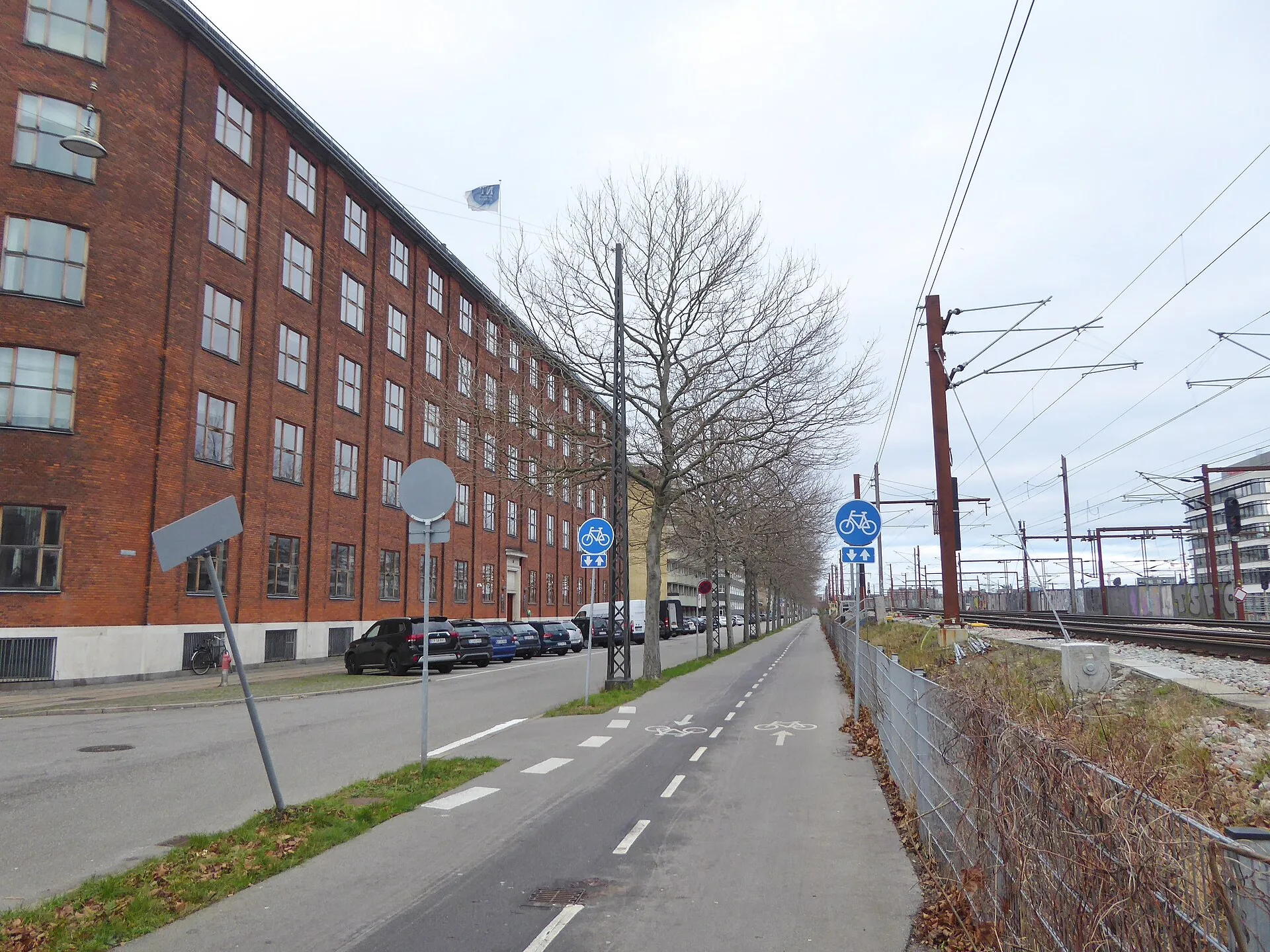
Copenhagen, Denmark: a city built around the bicycle
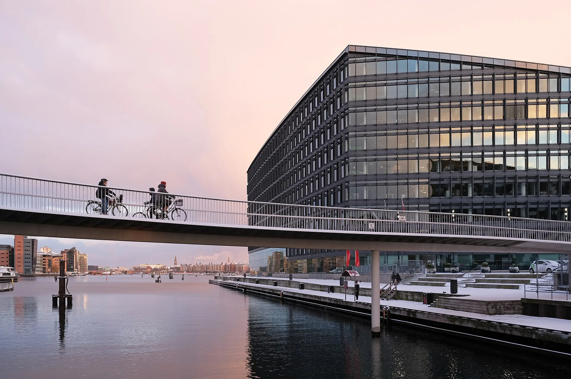
Copenhagen shows what happens when cycling is treated as transport rather than leisure. Over decades the city built a network of kerb-separated cycle tracks, green cycle routes and bridges for bikes and pedestrians, and synchronised traffic lights for cycling speeds on main routes. According to VisitDenmark, 44% of trips to work and education in Copenhagen were made by bicycle in 2019, and the city set a target of 50% by 2025. The lesson for other cities is that the share follows the infrastructure: people cycle when the route is continuous, direct and feels safe.
Curitiba, Brazil: bus rapid transit as the city’s spine
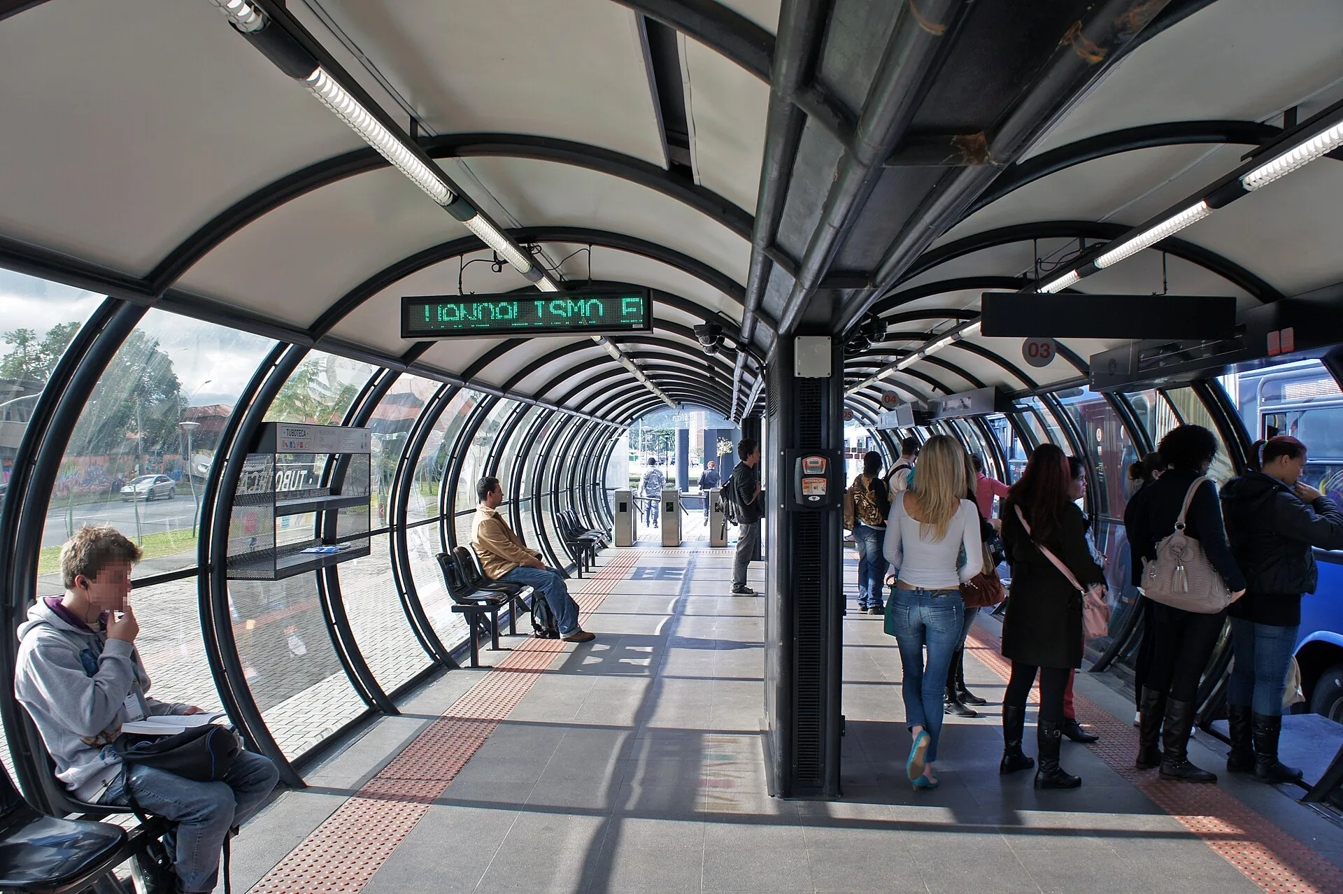
In the 1970s, under mayor Jaime Lerner, Curitiba chose to structure its growth along a few main axes served by express buses rather than build a metro it could not afford. The first dedicated bus corridor opened in 1974, and over time the city added its distinctive raised “tube” stations, where passengers pay before boarding and step level onto the bus. Zoning allowed higher density along the corridors and lower density away from them, tying land use to transport. Curitiba’s integrated transport network became the model for bus rapid transit systems worldwide, from Bogotá to Istanbul.
Freiburg-Vauban, Germany: the low-car neighbourhood
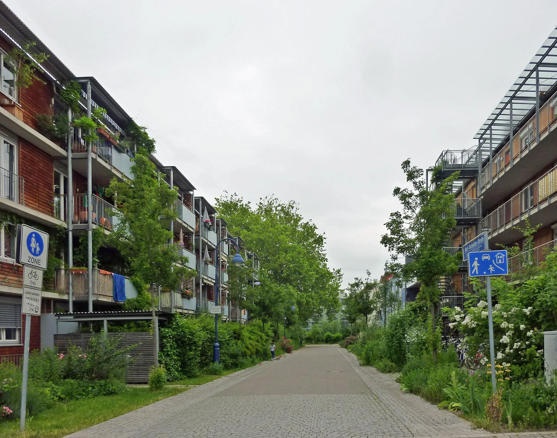
Vauban, built on a former military barracks site in Freiburg from the late 1990s, is a neighbourhood of compact terraced and apartment buildings, many built to very low-energy or passive house standards, with a tram line through its centre. Residents’ cars are parked in shared garages at the edge rather than at each front door, so the streets are calm enough for children to play in. Residents and building groups (Baugruppen) shaped much of the design, which is one reason the neighbourhood is often cited as an example of participatory planning.
Singapore: nature as infrastructure
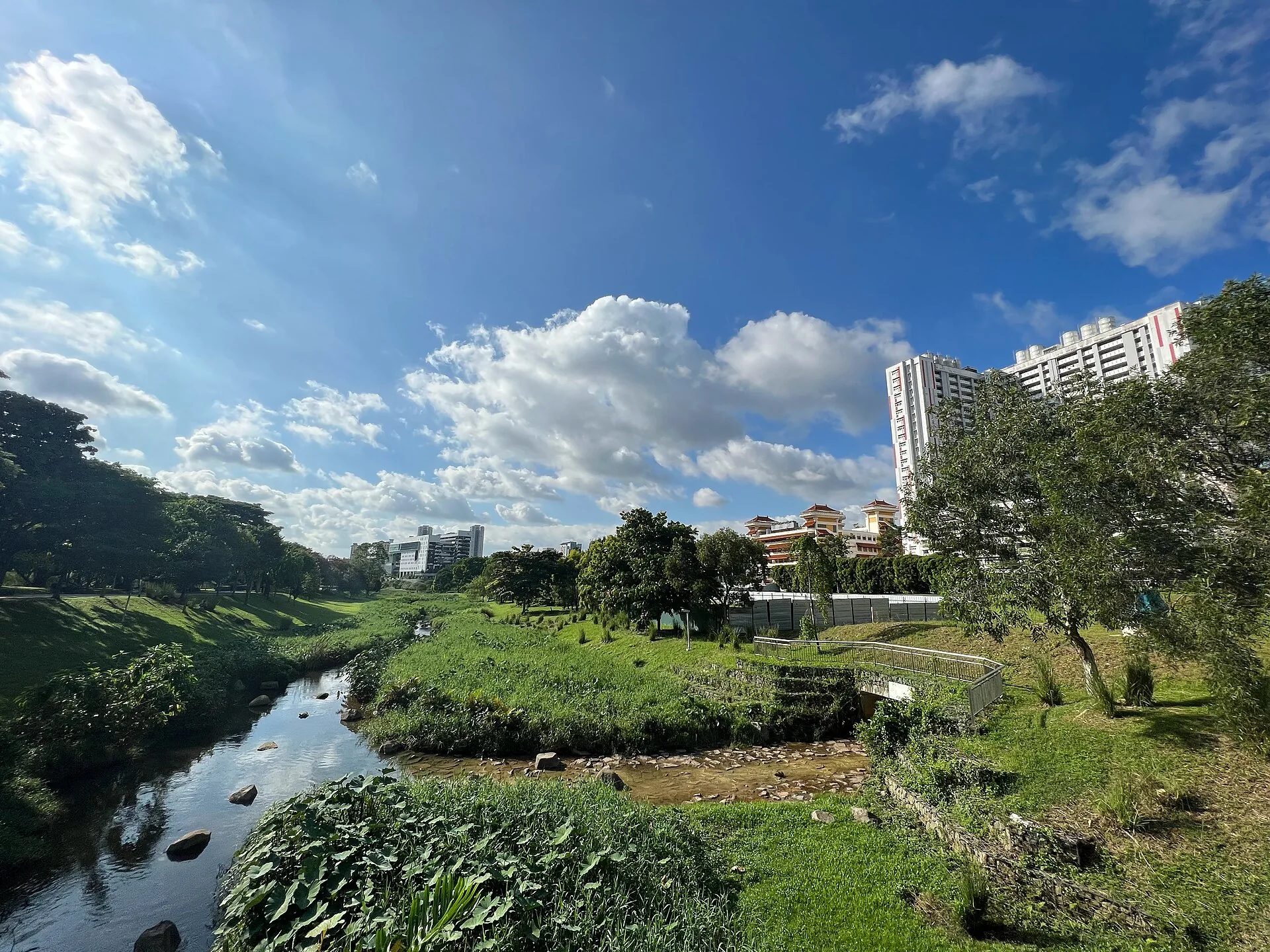
Singapore, one of the densest countries in the world, has made green and blue infrastructure a central planning tool. At Bishan-Ang Mo Kio Park, a straight concrete drainage channel was replaced with a naturalised, meandering river with planted banks, which carries floodwater, creates habitat and gives residents a park they can step down into. Programmes for sky gardens and green roofs extend the same thinking onto buildings, and park connectors link green spaces across the island.
Masdar City, Abu Dhabi: climate-responsive planning in the Gulf
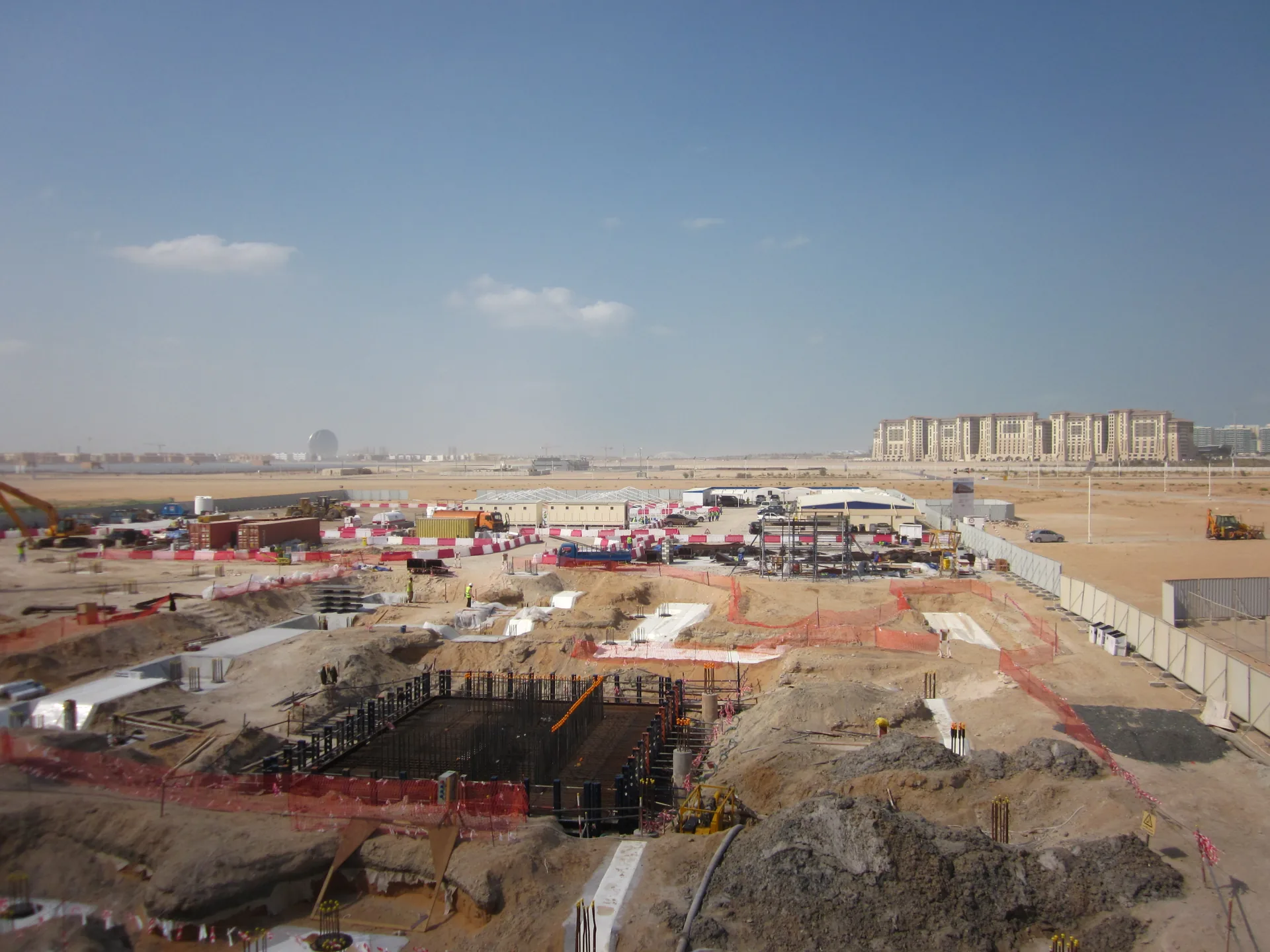
Masdar City, designed by Foster + Partners, applies traditional Arab urban strategies to a new district. Its streets are short and narrow and are angled to maximise shade, and a wind tower draws air through the public space. According to the Global Ecovillage Network’s profile, the street pattern and the 45-metre tower are designed to channel cooler breezes and make the streets noticeably cooler than the surrounding desert. The original plan for a zero-carbon, car-free city was scaled back after the 2008 financial crisis, and the district is still being built out, which is itself a lesson: ambitious targets need phasing and finance that can survive a downturn.
Historic cities offer case studies too. Many of the principles above, such as walkable blocks, shaded streets and civic squares, were standard practice before the car. Our article on the living legacy of Renaissance architecture traces how classical planning principles still inform contemporary projects.
Challenges and criticism
Sustainable urban planning is easy to describe and hard to deliver. The most common obstacles are:
- Car dependency already built in. Most existing cities were designed around cars, and retrofitting streets, parking and land use is slow and politically contested.
- Green gentrification. New parks, transit and cycle lanes can raise property values and push out the residents they were meant to benefit, unless affordable housing and tenant protections are planned alongside them.
- Short political cycles. A transit network or green corridor takes decades to mature, longer than most elected terms. Curitiba’s success relied on continuity across several administrations.
- Greenwashing. Flagship “eco-cities” can attract attention while the rest of the city continues to sprawl. Judge a project by measured results (trips, energy use, temperatures, affordability), not renderings.
- Climate in hot regions. In the Gulf and North Africa, outdoor comfort in summer limits walking and cycling unless streets are shaded and connected to transit, which makes urban form and shade as important as transport policy.
- Data and capacity. Many municipalities lack the data, staff or budgets to model, monitor and maintain sustainable infrastructure.
How to apply sustainable urban planning in your own projects
Even a single building or small development can contribute. Start with location: is the site walkable and served by transit? Then ask how the ground floor meets the street, whether parking can be reduced or shared, how the project handles rainwater and shade, and whether it adds trees and public space. At masterplan scale, set measurable targets from the start, such as the share of homes within a 10-minute walk of a station, tree canopy cover or the percentage of affordable housing, and monitor them after completion.
Test a planning policy at street and household scale
Take one policy and trace its consequences for an actual block: access to daily services, safe crossings, shade, affordable housing and the management of rainwater. Compare the benefits and burdens for people who cannot drive or pay for new technology. Use an existing-condition baseline before claiming an improvement, and record whether a figure measures policy adoption or an outcome. A compact development can still perform poorly if its streets are unsafe or its residents are displaced. Explain the trade-offs rather than presenting one city as a complete model.
For the related question of summer comfort, our guide to passive cooling systems explains the conditions in which different strategies can help.
Summary
Sustainable urban planning means compact, mixed-use neighbourhoods organised around public transport, streets designed for people, green and blue infrastructure that works as hard as pipes and roads, climate-responsive urban form, and an equitable process. Copenhagen, Curitiba, Vauban, Singapore and Masdar City each demonstrate one part of that picture, and each also shows its limits. The common lesson is that the plan only matters if it is delivered consistently over decades and measured honestly along the way.

Luca Moretti is a content strategist with a foundation in urban design and architecture. Based in Milan, he focuses on writing that bridges aesthetics, material culture, and everyday spatial experiences.