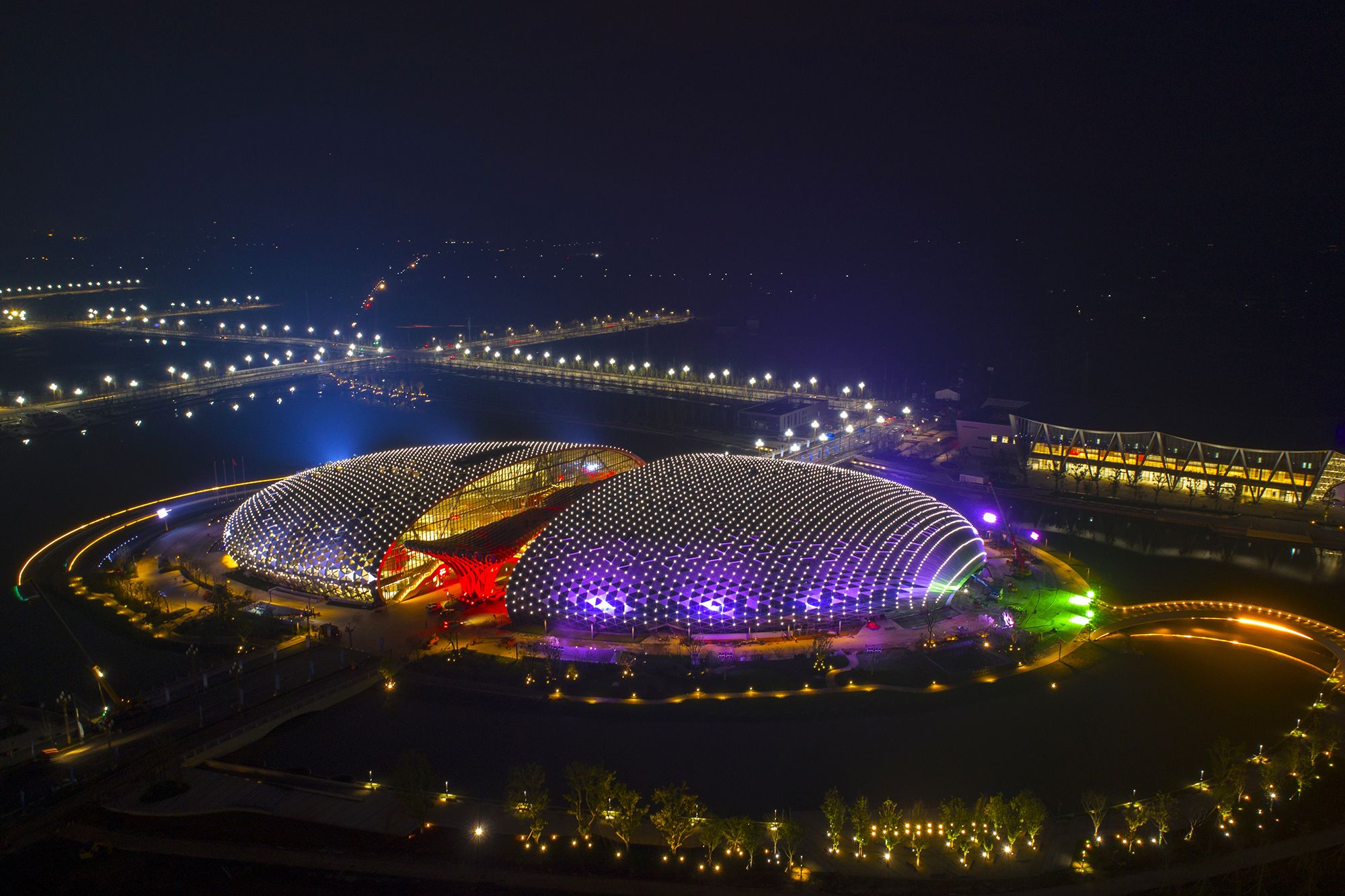
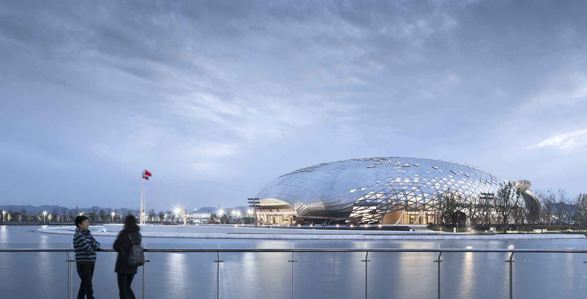
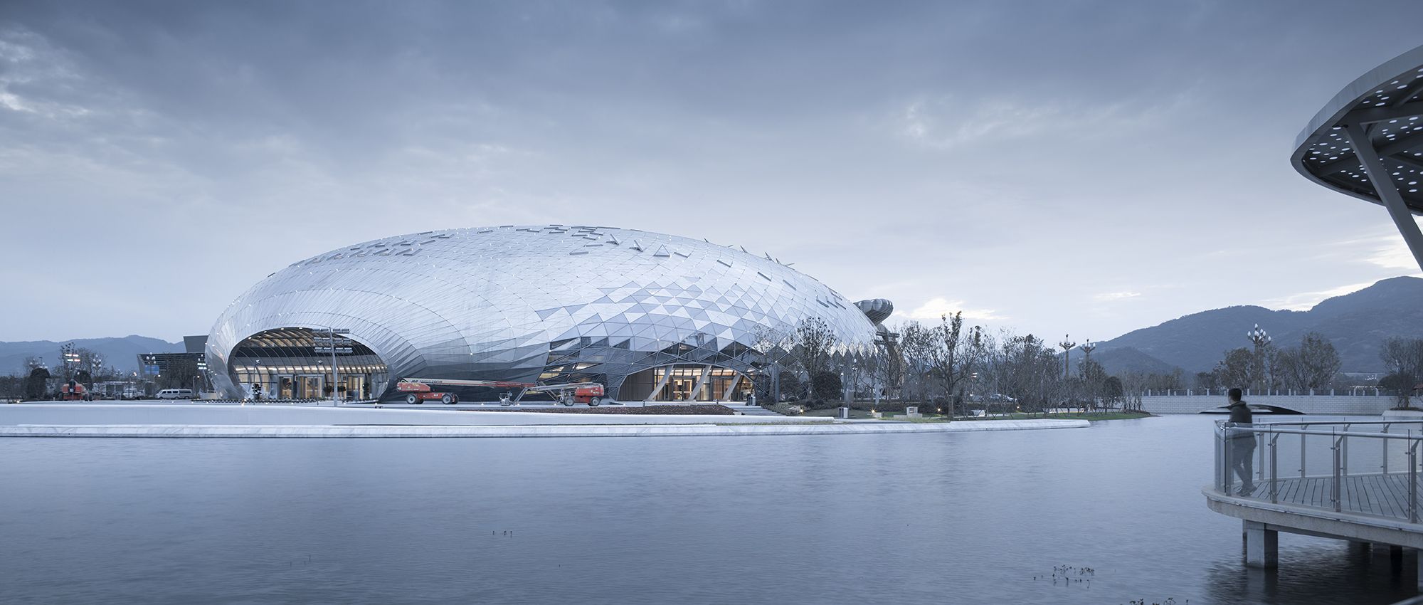
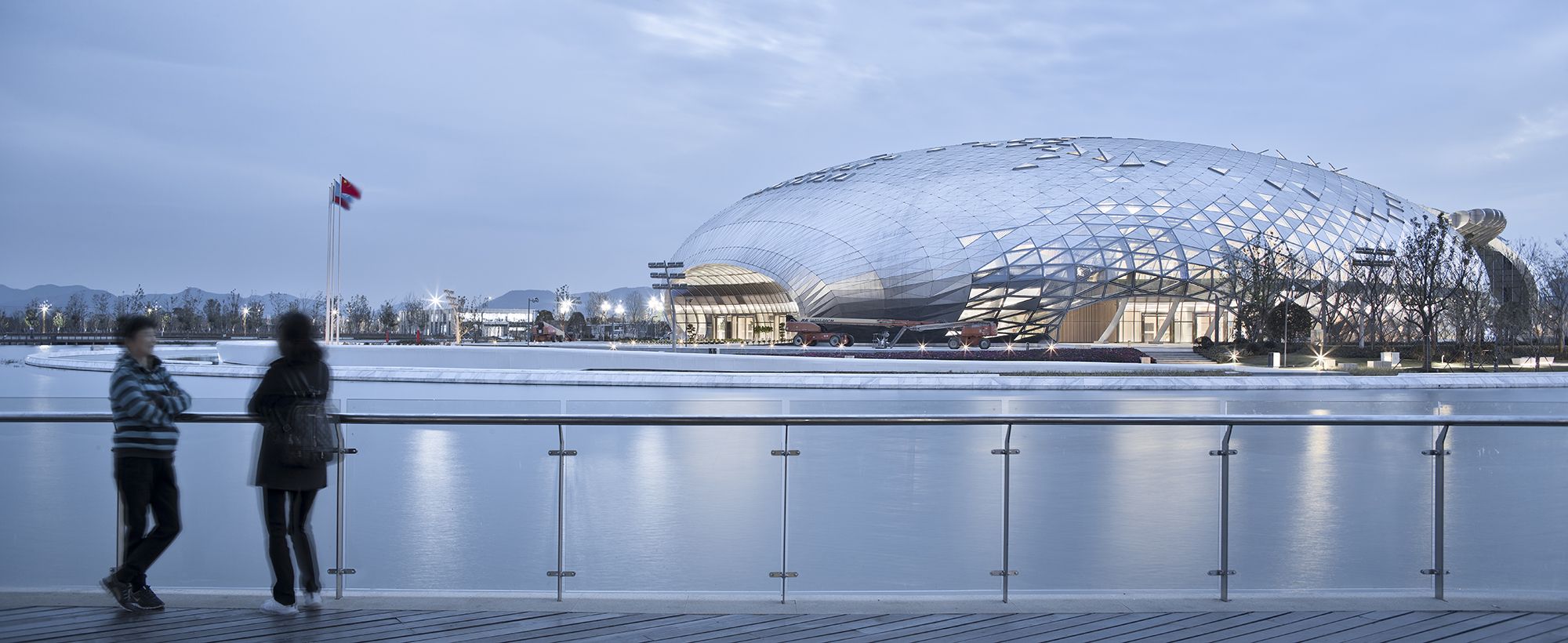
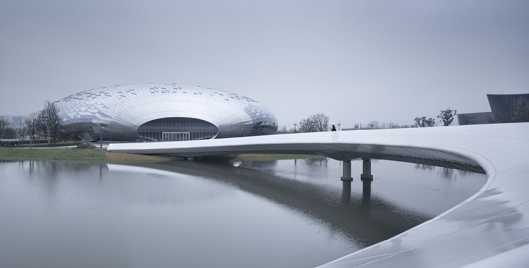
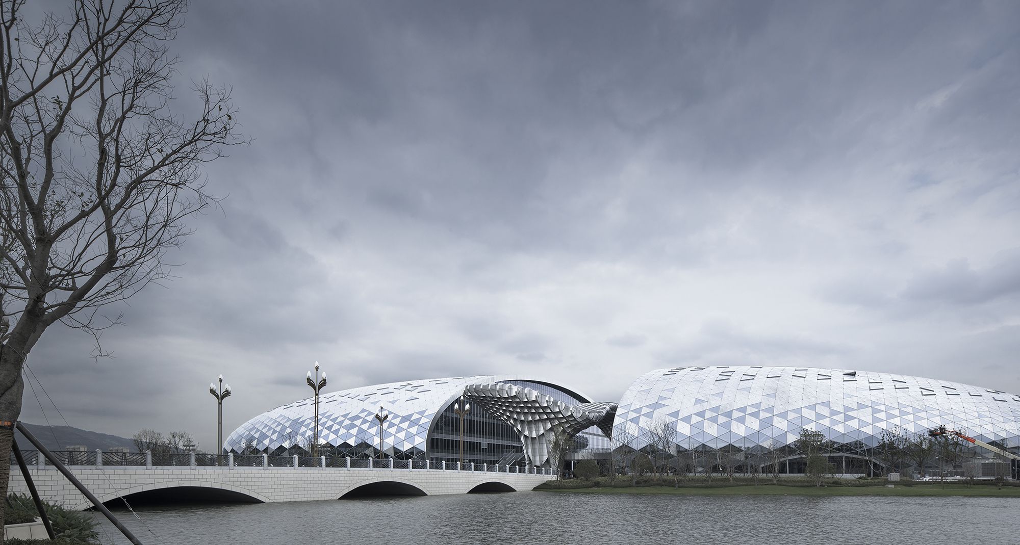
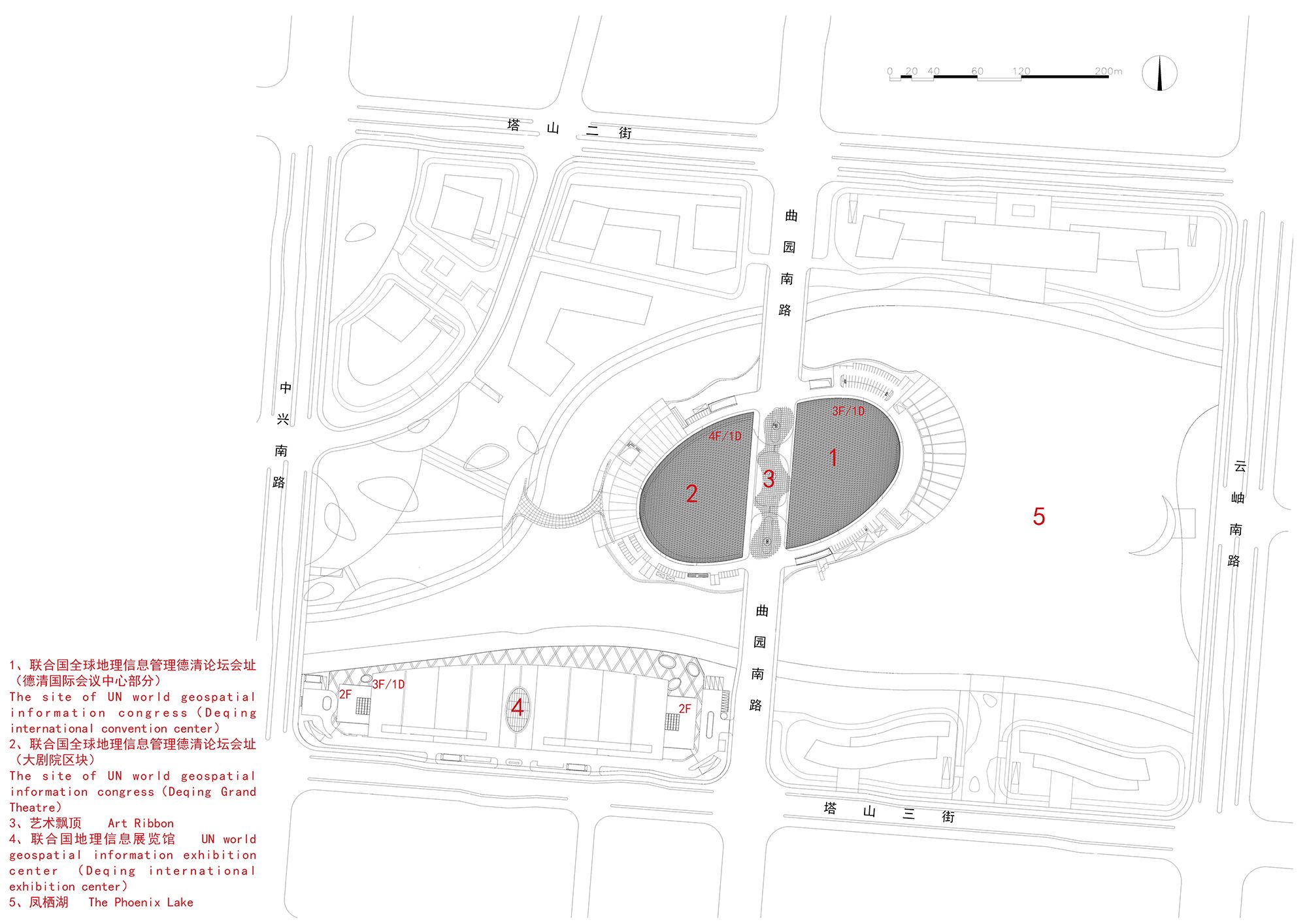
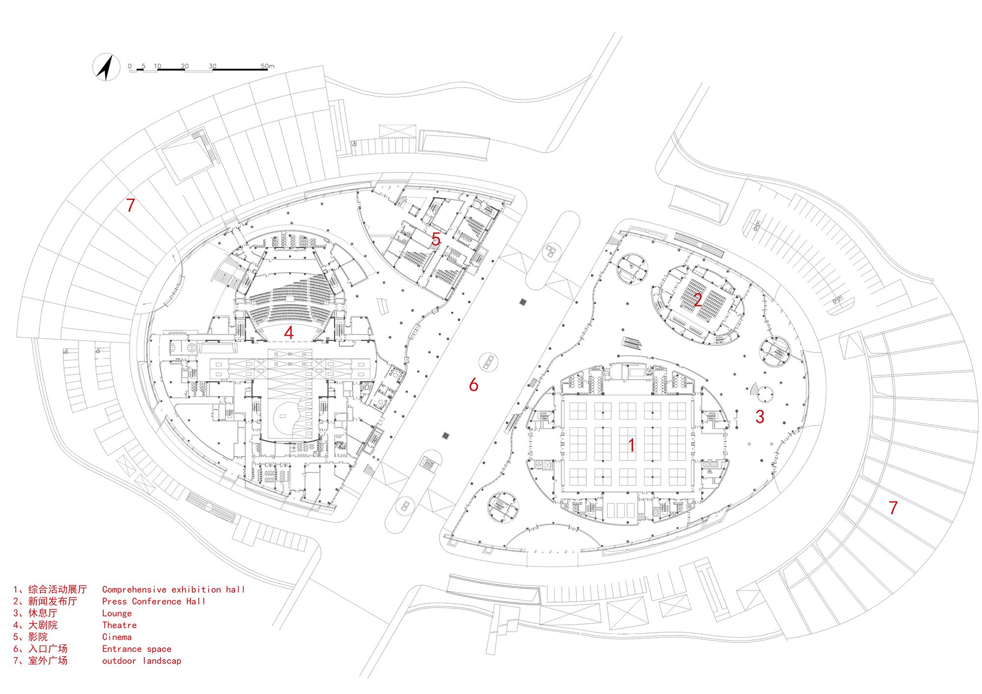
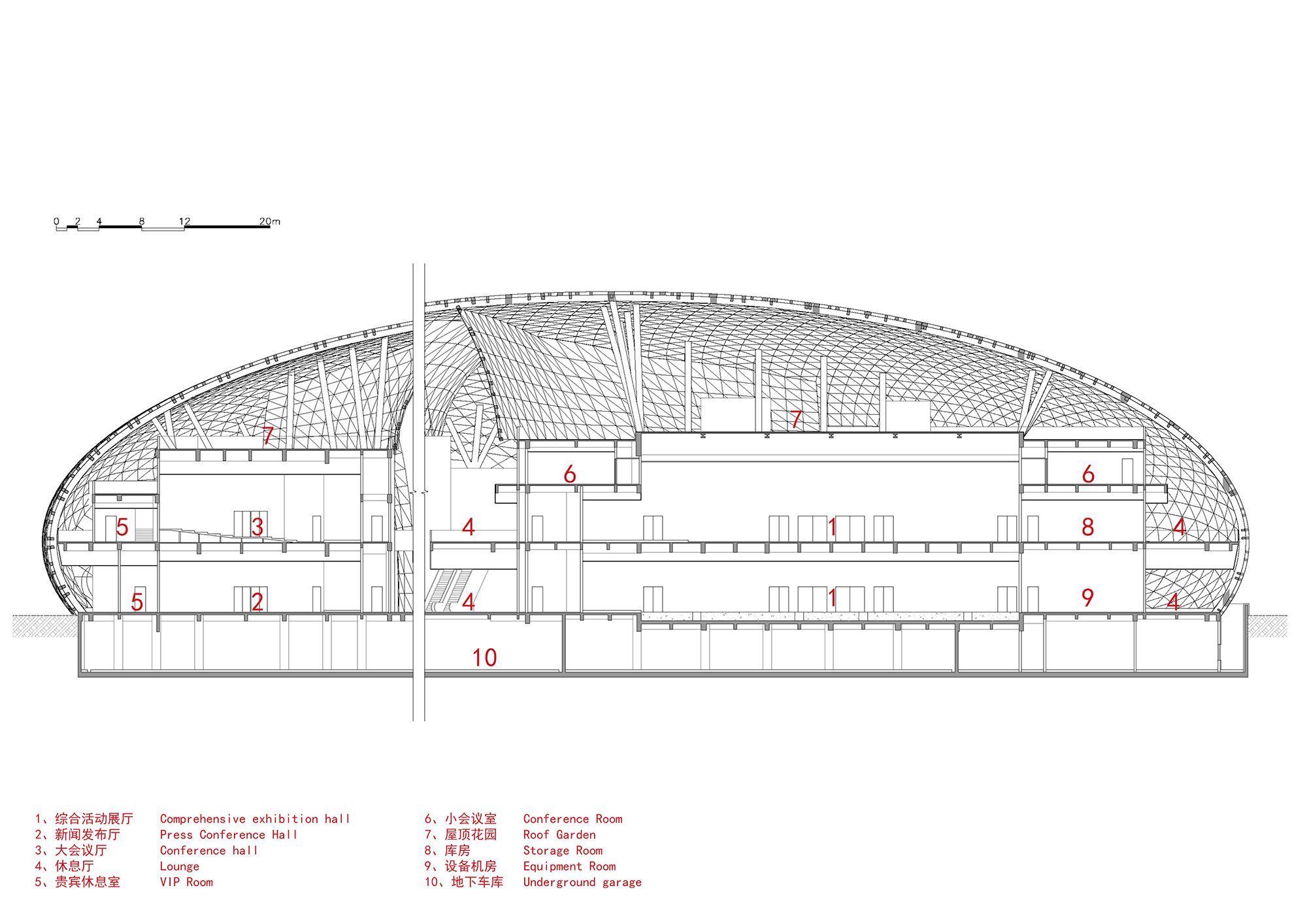
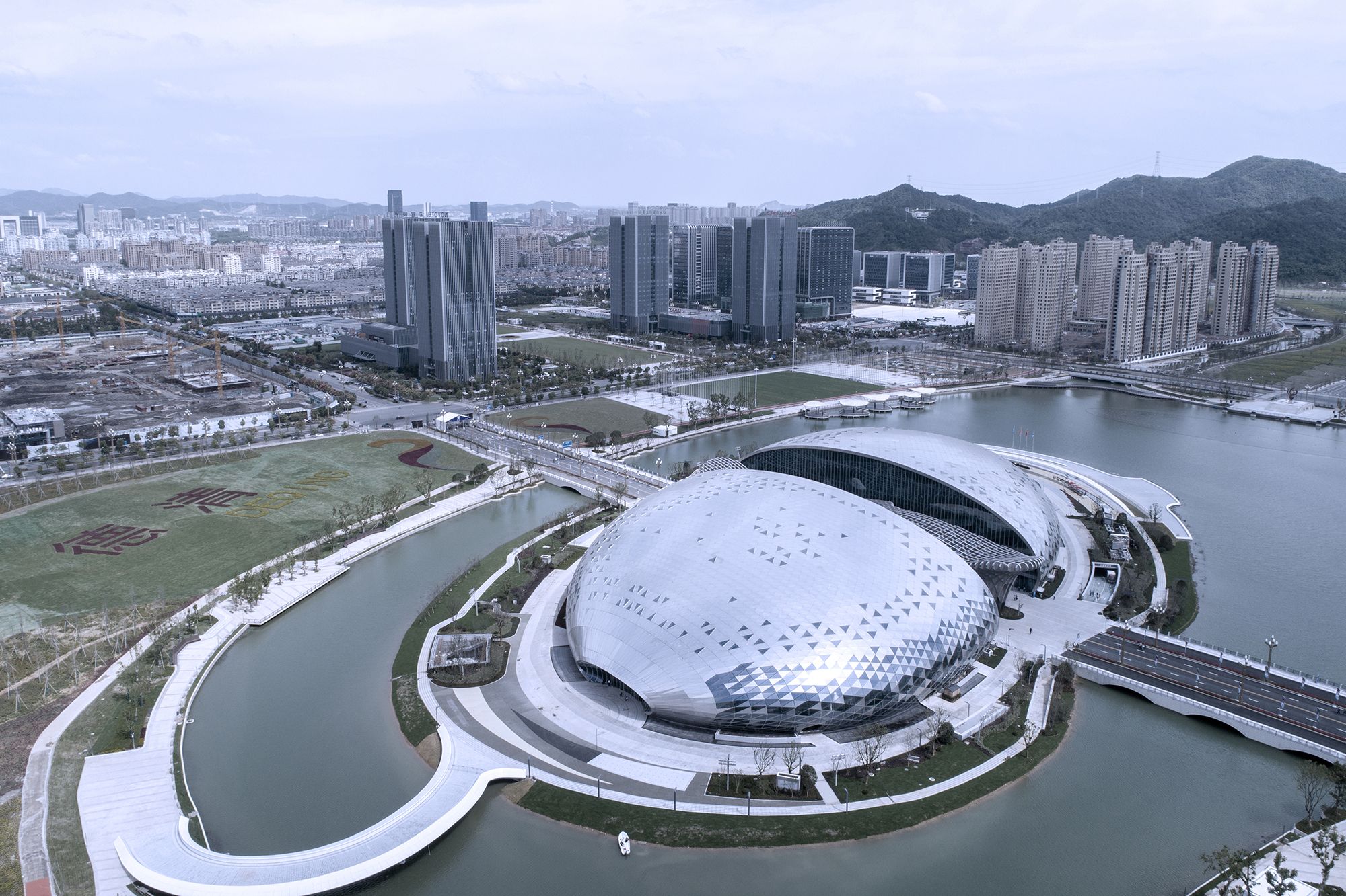
Designed by UAD, The project is located in Geographic Information Town, south of Deqing County, China. It is, specifically, between Tashan No.2 Street and Tashan No.3 Street, and across Quyuan Road. Built on an island on The Phoenix Lake, the grand architecture is a window for the world to see Deqing County. The building’s above-ground area is 42,556 square meters, with the main structure of three floors and a height of 23.95 meters, and the underground construction area is 29,507 square meters.
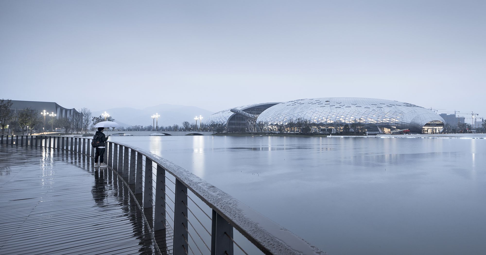
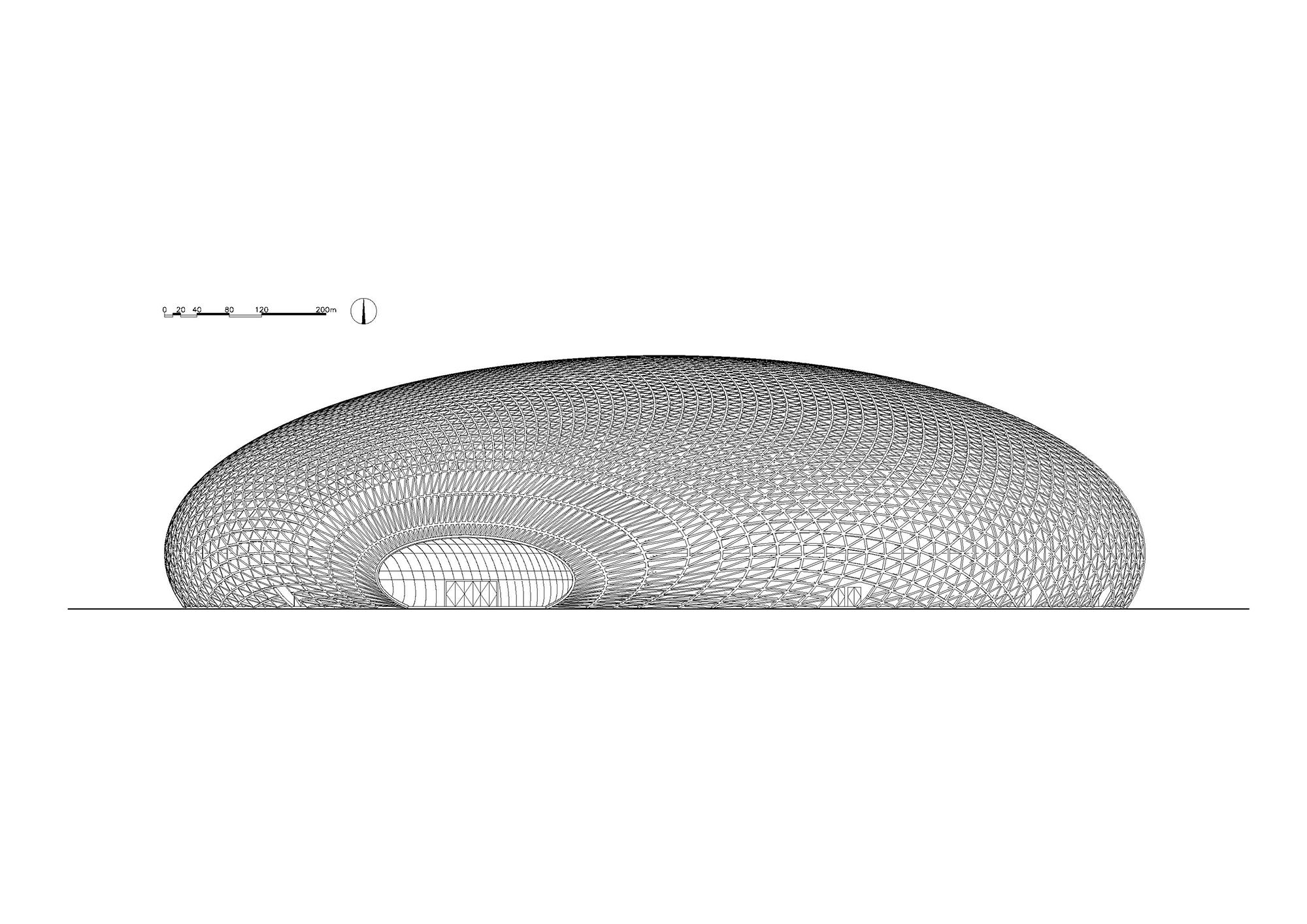
The project takes on an ellipsoid shape, which is consistent with the form of the island where it is located. In this way, the overall architecture matches well with the site environment, and perfectly integrates into Deqing County Geographic Information Town with a posture of “harmony in diversity”.
photography by © Jun Caiphotography by © Qiang Zhao
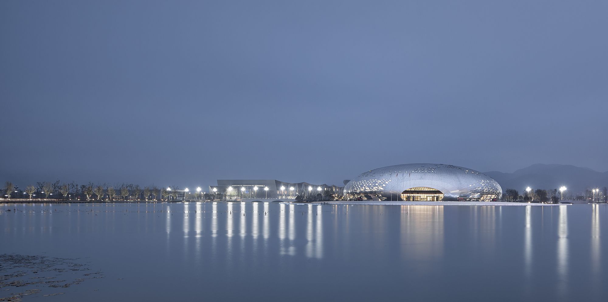
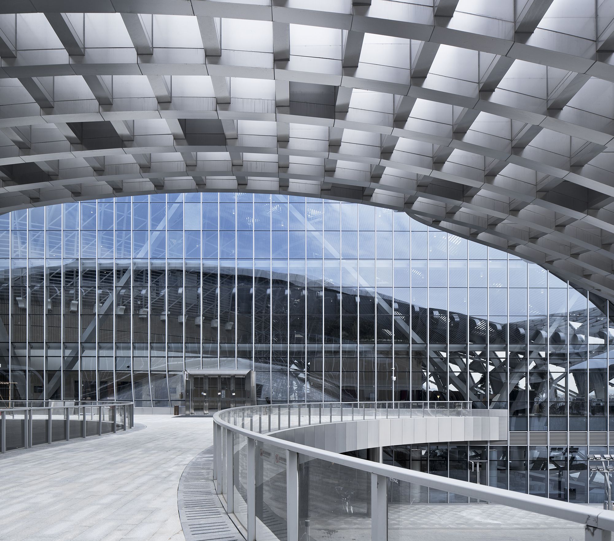
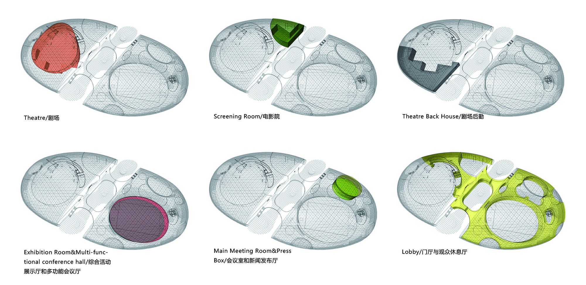
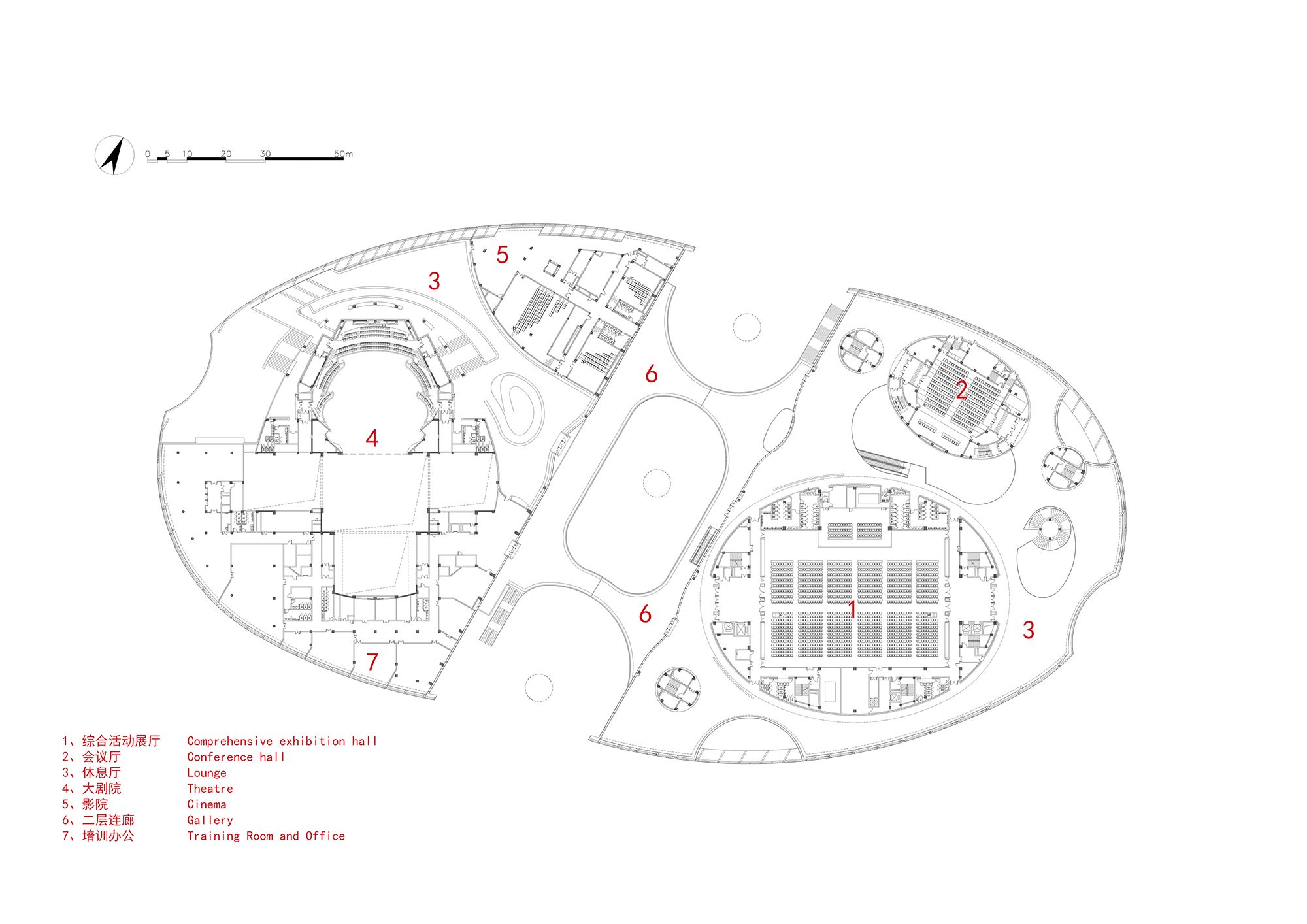
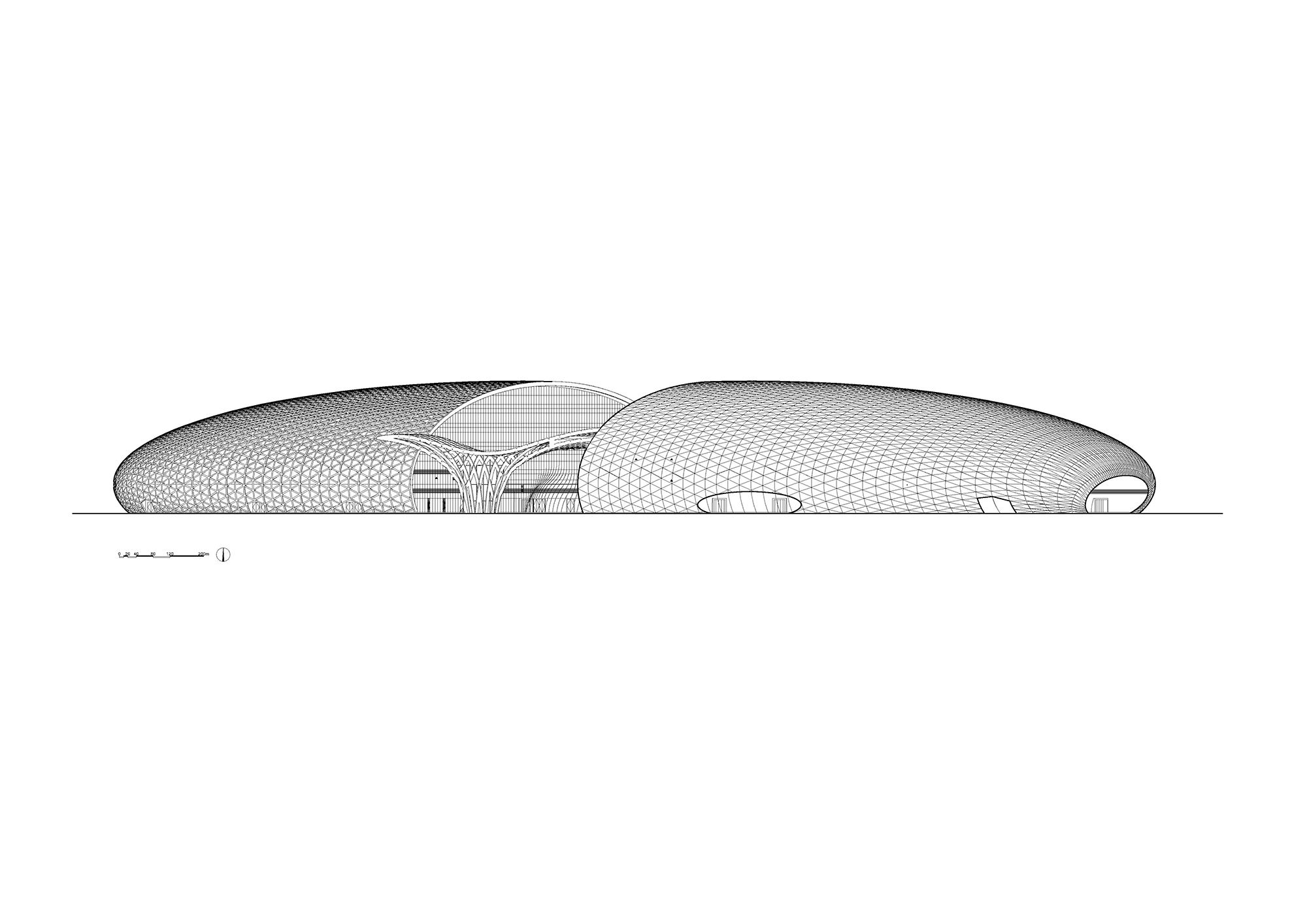
Since Quyuan Road passes through the land, the building was divided into two parts, with its secondary entrance spaces along the road. In the east and west hemispheres, the main entrances of the conference center and the grand theatre were set up separately, which face the lake and are coordinated with the surroundings.
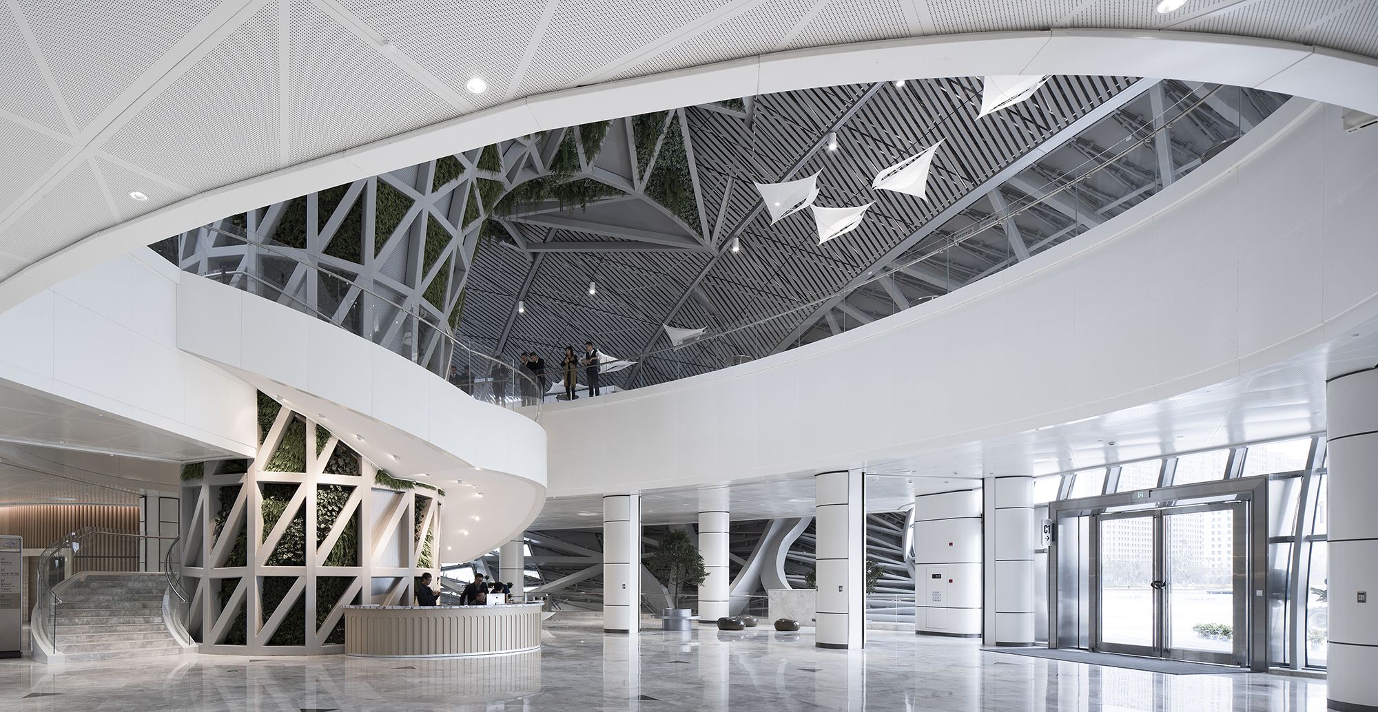
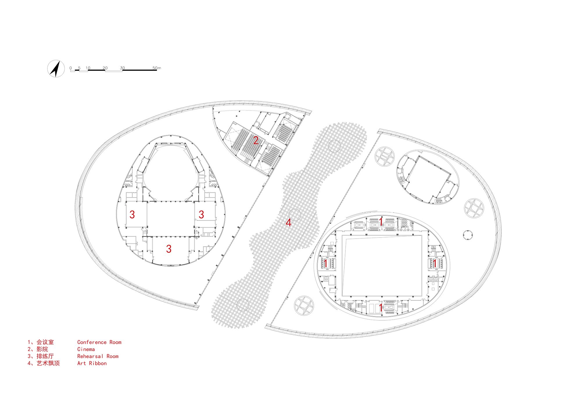
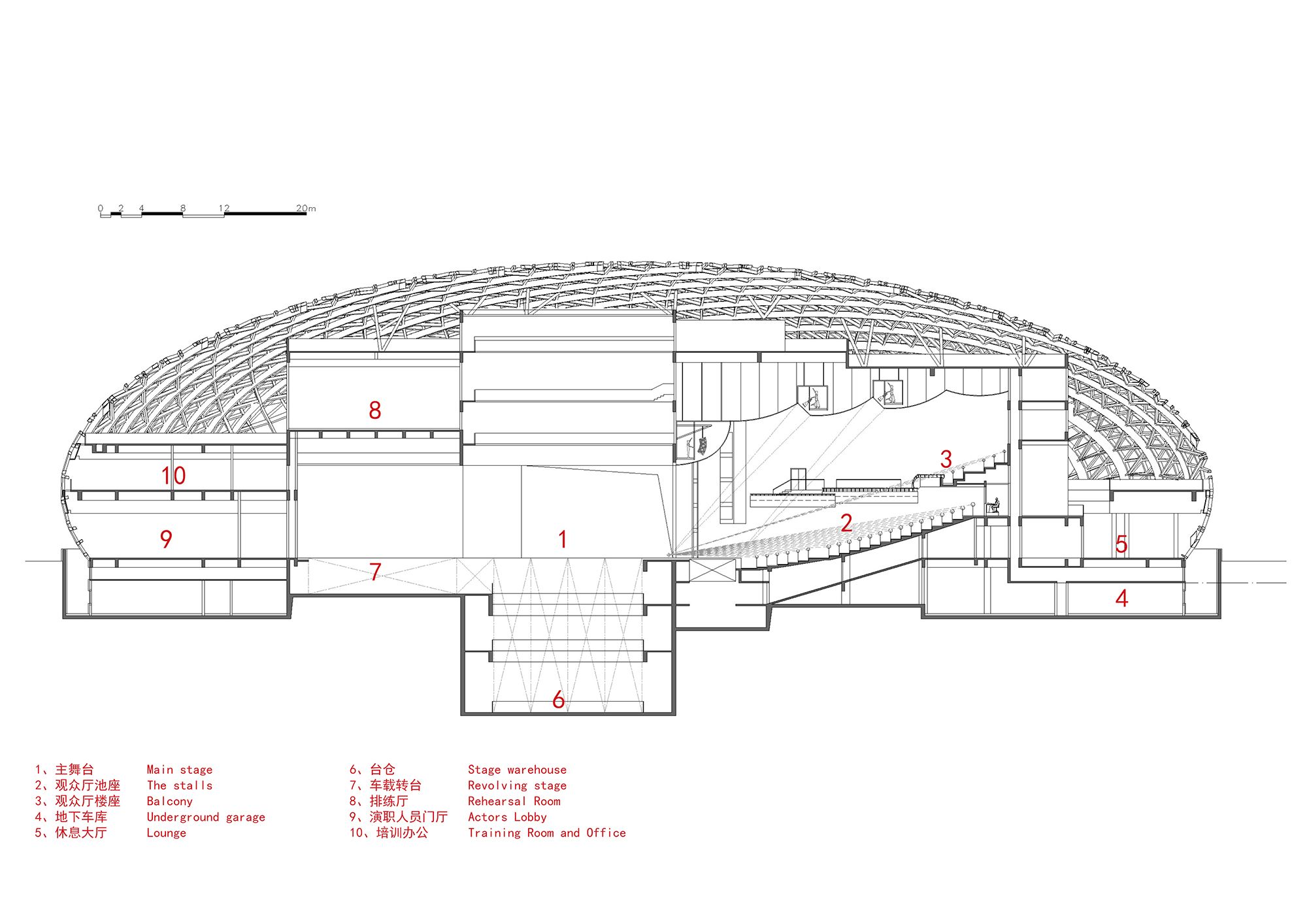
The eastern hemisphere of the architecture consists of the main venue for 2000 people, a multi-functional hall for 500 people, a small lecture hall for 300 people and several conference rooms, while west hemisphere contains a grand theater for 1000 people, a cinema and so on. All the internal halls can be connected to each other through corridors and shared lobbies.
photography by © Jun Cai
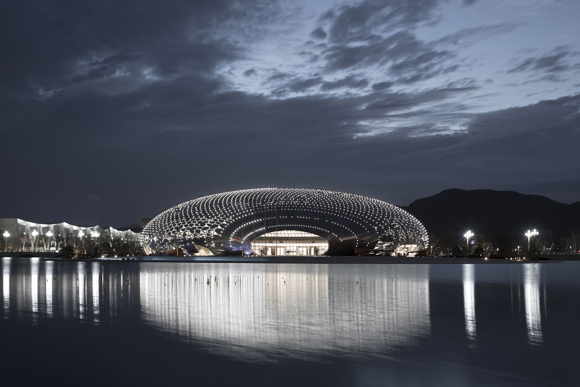
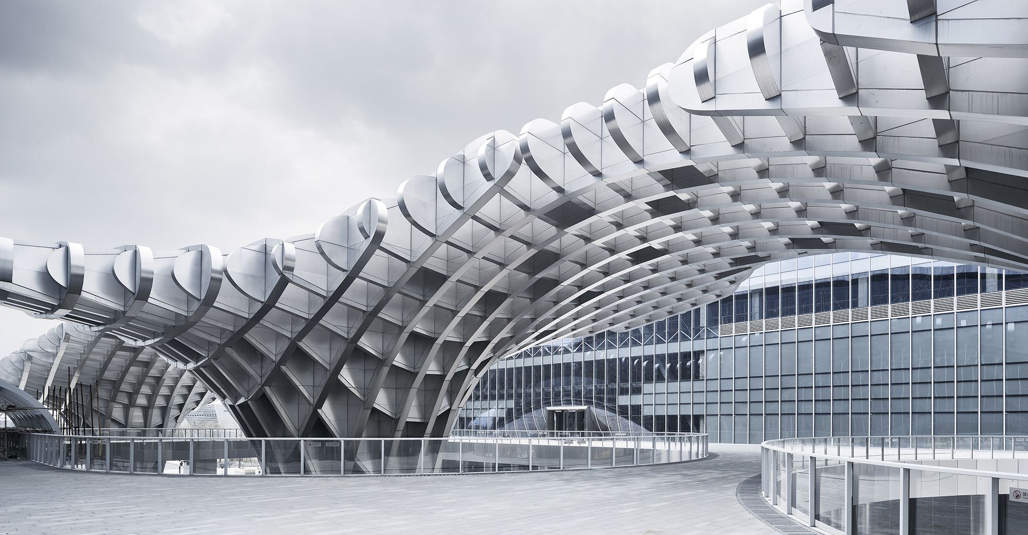
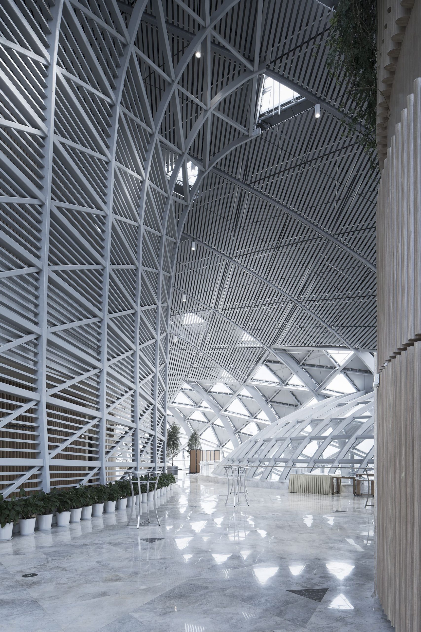
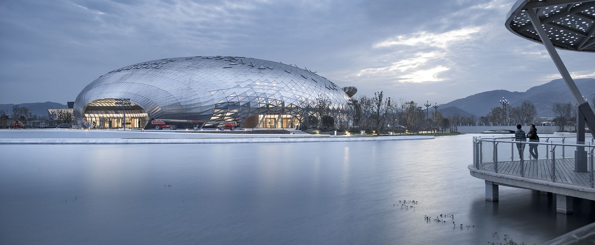
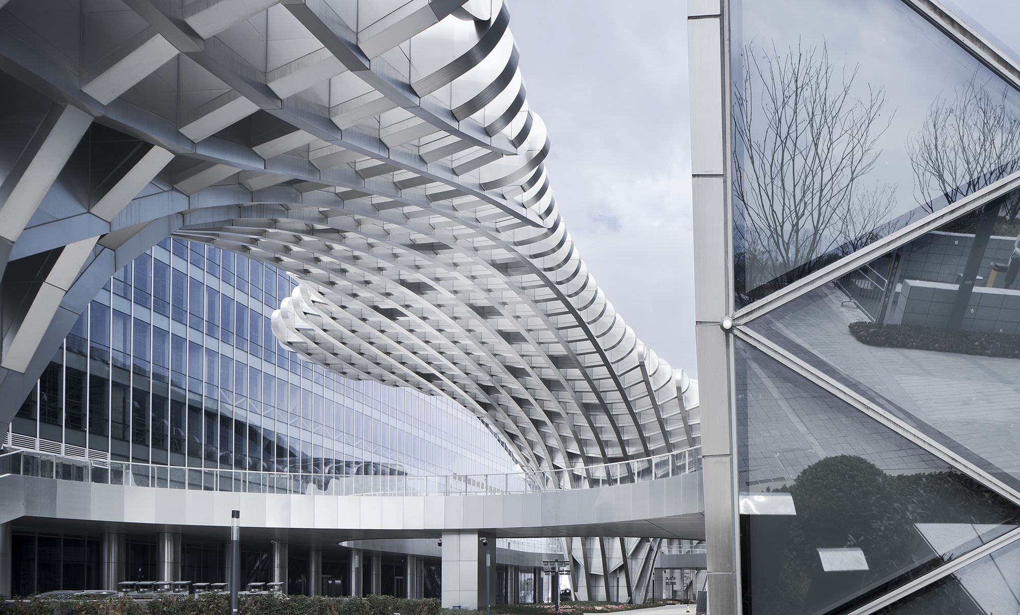
The design used the imagery of a phoenix that breaks through the clouds and dances in the sky. The overall architecture looks like a white glimmering cloud, lying silently on The Phoenix Lake and integrating with the surrounding environment. The three-dimensional and hollowed-out metal roof looks like a “flying phoenix” that spreads the wings and soars highly, presenting a poetic picture. Viewing the entire building from a distance, the quietness of clouds and “the flying of the Phoenix” form a distinct contrast, full of a sense of drama.
With the glimmering and flowing “cloud” highlighting the lightness and flexibility of “the Phoenix”, the whole building indicates the touching moment that the phoenix flies through the clouds, and predicts the promising future of Geographical Information Town.
photography by © Qiang Zhao
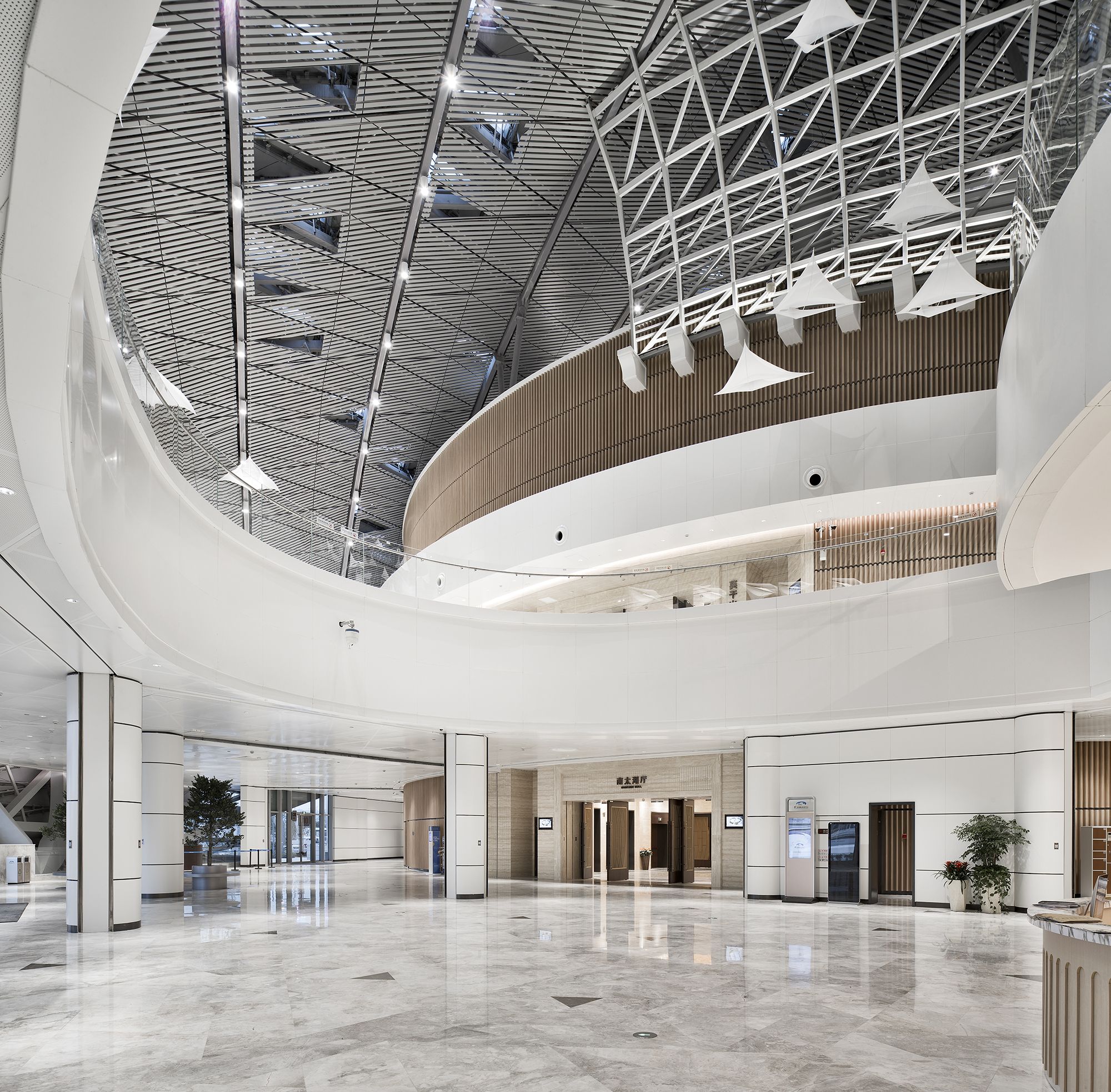
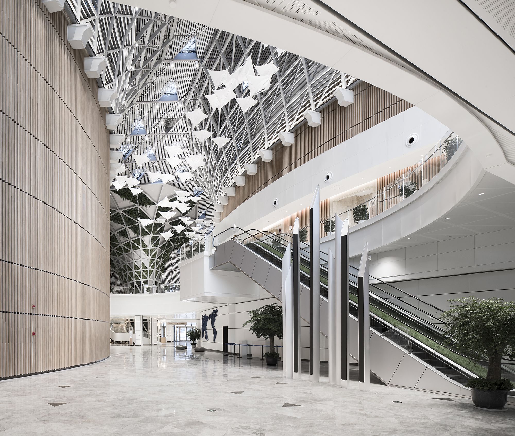
Featuring simple structural forms, the interior space was endowed with an artistic conception of “woods and shades of bamboos nearby, mountains and flowing waters at distance” through the emphasis of space, the collocation of materials, the introduction of devices and the appropriate integration of local elements. It organically combines the mountains, waters, clouds, and trees of Deqing County, vividly presenting the geographical features of the beautiful landscape.
Taking the creation of pastoral landscape in the County as the starting point, the design aims to indicate the local geographical features beyond formal level, through flexible outdoor and indoor spaces, and the dynamic exterior shape of the architecture. It is an urban public space, where every guest, from the world, can feel the modern and natural artistic conception, with thought waves and emotional resonance being inspired.
photography by © Qiang Zhao
Project Info:
Architects: The Architectural Design & Research Institute of Zhejiang University
Location: Zhejiang Province, China
Chief Architects: Zhenling Wu, Bing Chen
Design Team: Yu Chen, Rui Zhu, Jiachen Zhang, Zhenyue Fan, Xiaobing Cai, Tao Fang
Area: 72063.0 m2
Project Year: 2018
Photographs: Jun Cai, Qiang Zhao
Project Name: United Nations Geospatial Information Management Forum Permanent Site of Deqing County