

A team led by ZHA has released its concept proposal for the Benghazi 2050 city plan, a framework meant to guide the growth of Libya’s historic port city toward mid-century. The proposal, called the “Next Generation City Plan,” pairs the identity of Benghazi with the planning technology needed to manage rapid urbanization. It joins ZHA with A&O TEC, Prior + Partners, Homa, Buro Happold, Systematica, and Fichtner.
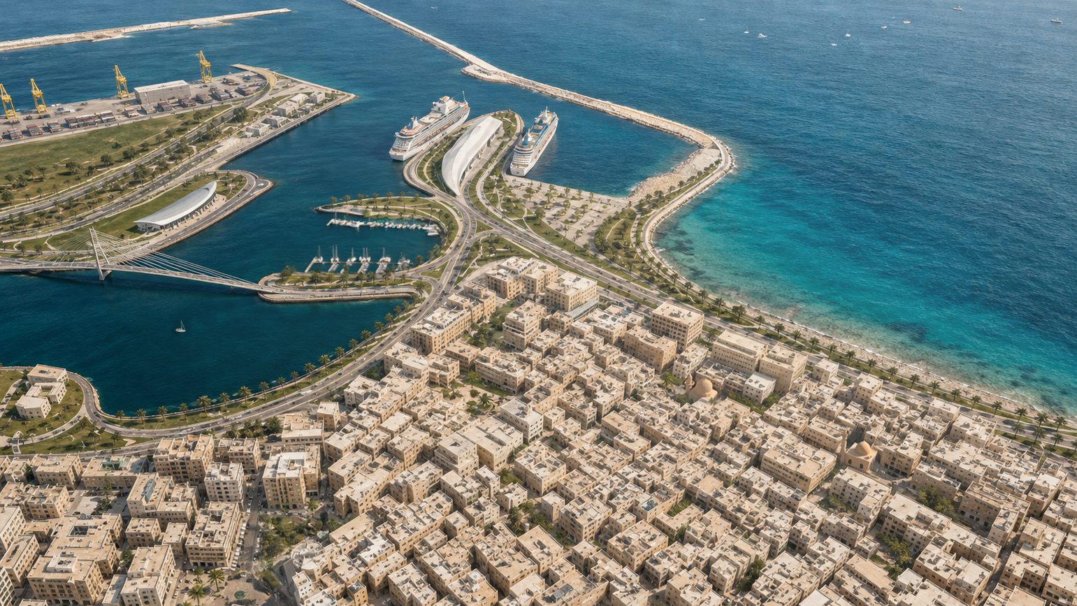
Benghazi 2050: Vision and Digital Planning Hub. Old Town. Image Courtesy of ZHA
Benghazi sits on the Mediterranean coast, and it serves as the historical and cultural capital of eastern Libya. The city anchors the economy of the eastern Cyrenaica region as a commercial center. ZHA reports that Benghazi is entering a period of rapid growth, expansion, and renewal, backed by significant investment in its infrastructure, neighborhoods, and local economy.
The proposal was developed for A&O TEC, an engineering, consulting, and trading firm headquartered in Germany. To respond to that growth, A&O TEC has argued for a “coordinated urban framework” that protects and restores the link between the city and its waterfront. The firm wants the plan to celebrate the city’s heritage while building “a more connected, livable, and resilient city.”
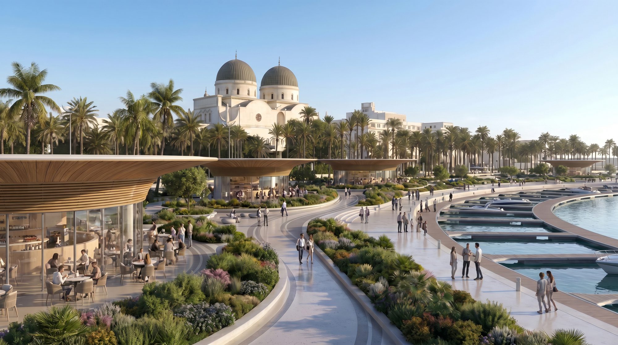
Benghazi 2050: Vision and Digital Planning Hub. Old Town waterfront. Image Courtesy of ZHA
The Benghazi 2050 city plan splits into two parts, which together shape how the city will develop. The first is the Vision and Spatial Strategy, an interpretation of the city’s character and collective memory turned into an adaptable framework for development. The second is the Digital Planning Hub, an evidence-based model that maps the city to find its potential and the forces shaping its growth.
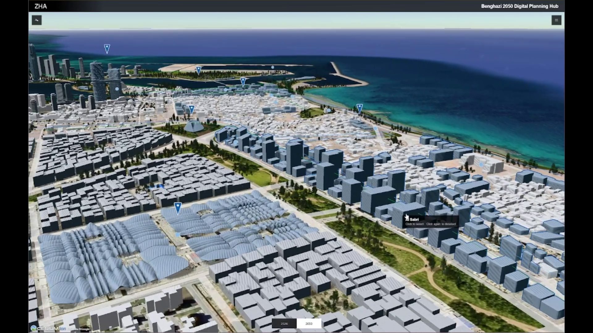
The Vision and Spatial Strategy proposes a framework for transformation across the whole metropolitan area. It connects the historic center and shoreline with new residential neighborhoods and metropolitan districts through public transport systems and pedestrian routes, while marking out new employment and knowledge districts. The framework works as a guide or matrix, so it can enable managed urban expansion and fold natural areas into the city to support water management and ecological diversity.
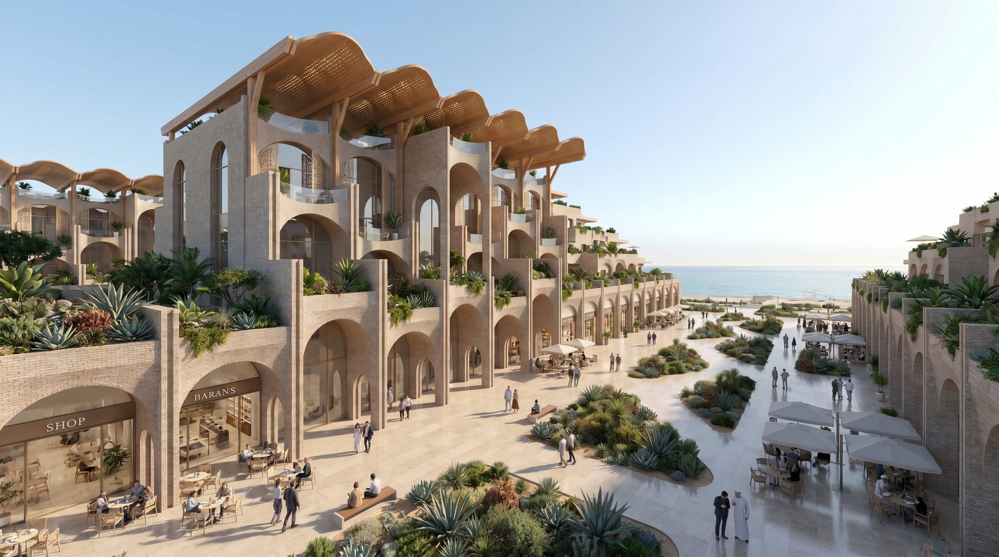
Benghazi 2050: Vision and Digital Planning Hub. Al Sabri residential district. Image Courtesy of ZHA
The strategy draws its energy from three priorities, which are connection, adaptability, and restoration. Because the framework stays flexible, it can evolve over time and coordinate individual projects and investments across the city toward 2050. That approach lets separate developments read as parts of a single, managed plan rather than as isolated efforts.
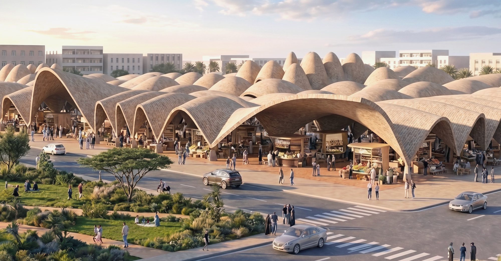
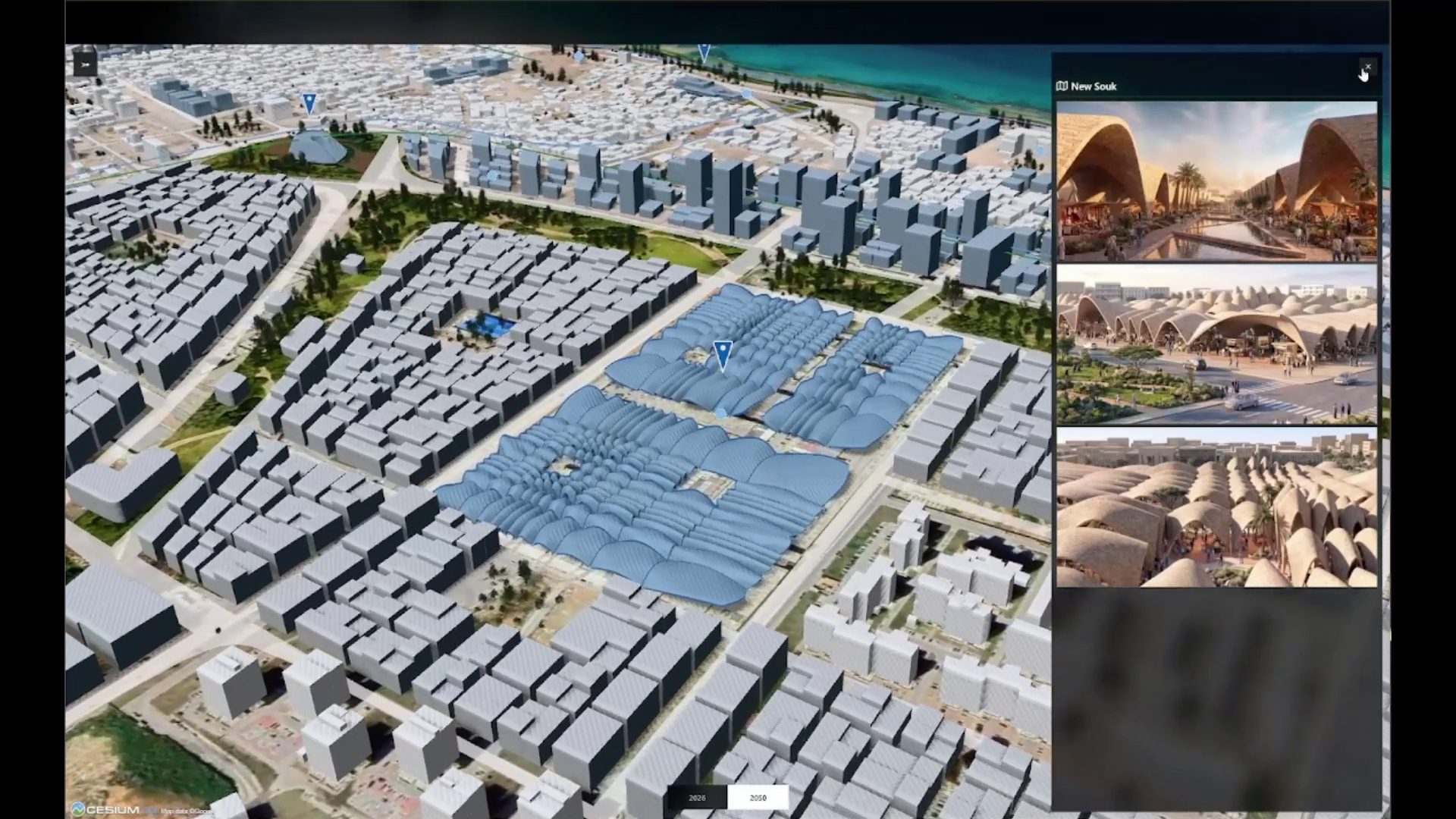
Benghazi 2050: Vision and Digital Planning Hub. Central Souk corner entry. Image Courtesy of ZHA
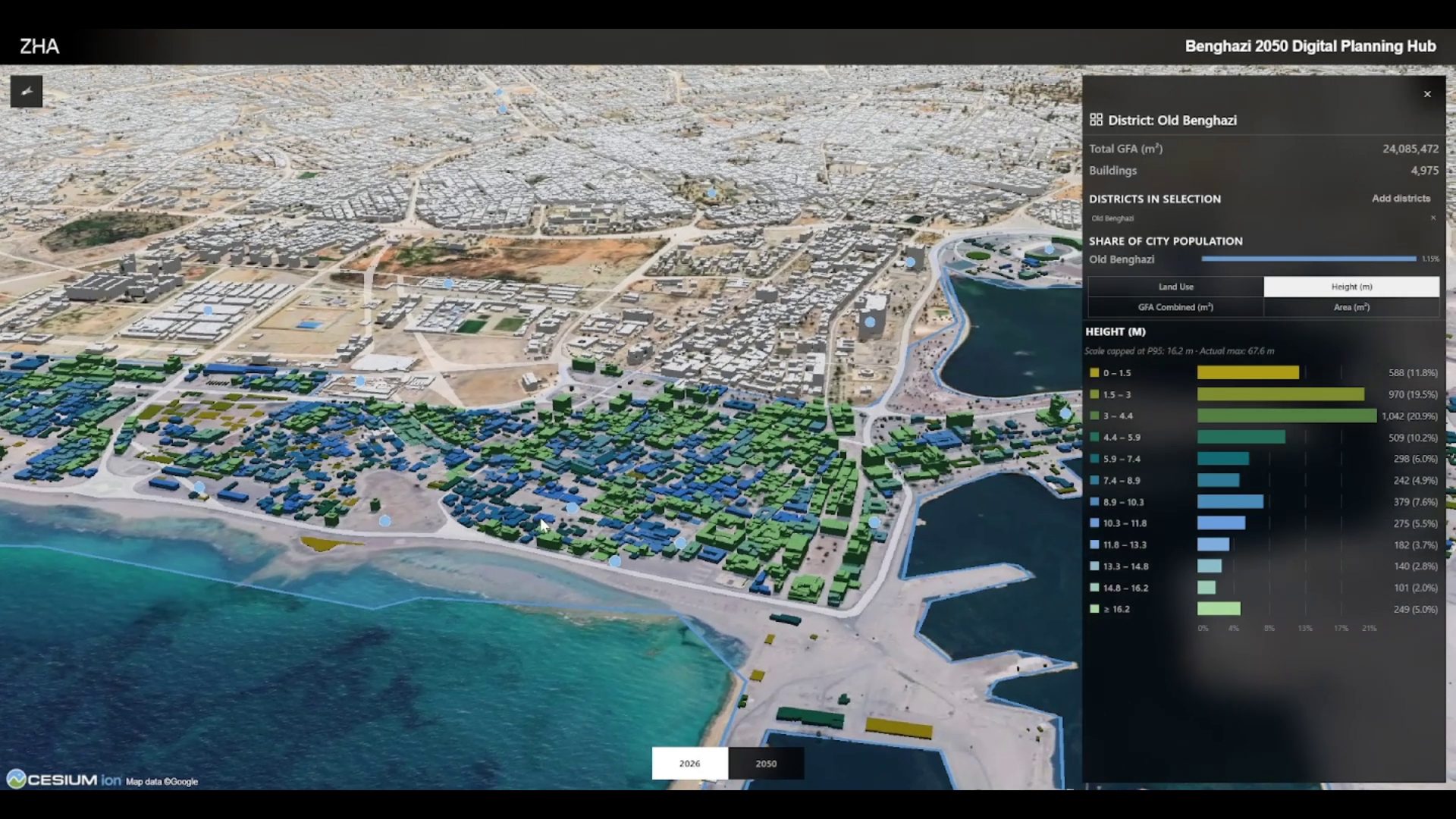
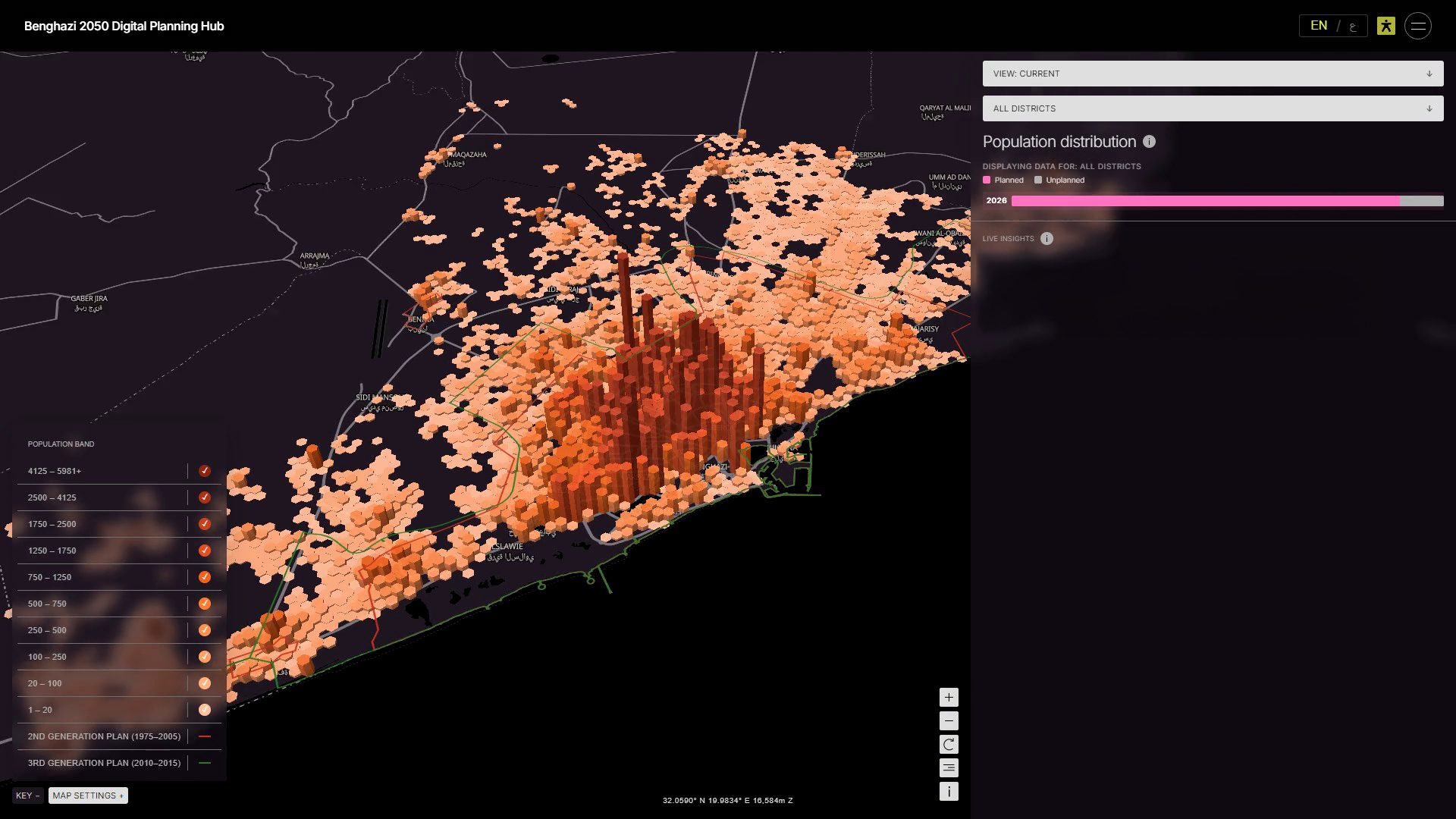
A shared evidence base supports this spatial framework, and that base is the Benghazi 2050: Digital Planning Hub. The platform draws on evaluated datasets and new digital information about existing urban, socio-economic, environmental, and infrastructural conditions across the metropolitan area. It maps the city to identify where growth should go, so decisions rest on measured conditions rather than assumption.
The Hub gathers data on the city’s societal, natural, and built environment inside one shared spatial interface. That single view lets different stakeholders engage with the plan while new proposals can be understood within their wider urban context. The team designed the Hub as a starting point for the Next Generation City Plan and as the foundation for a digital twin, a live virtual model of the city that supports long-term planning and delivery.
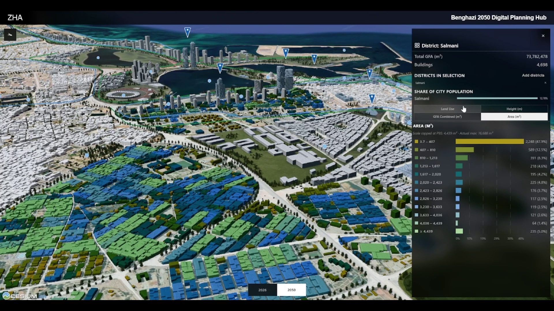
Benghazi 2050: Vision and Digital Planning Hub. 3D data overlay. Image Courtesy of ZHA
The Hub pulls together several layers of information that planners can query together. These metrics give the plan a common reference point as the city grows and renews.
- Data: Geographic Information Systems (GIS) and geospatial datasets
- Models: three-dimensional urban models
- Demographics: population and land-use information
- Mobility: transport and infrastructure networks
- Environment: environmental and resilience analysis
- Pipeline: ongoing development projects and future planning scenarios
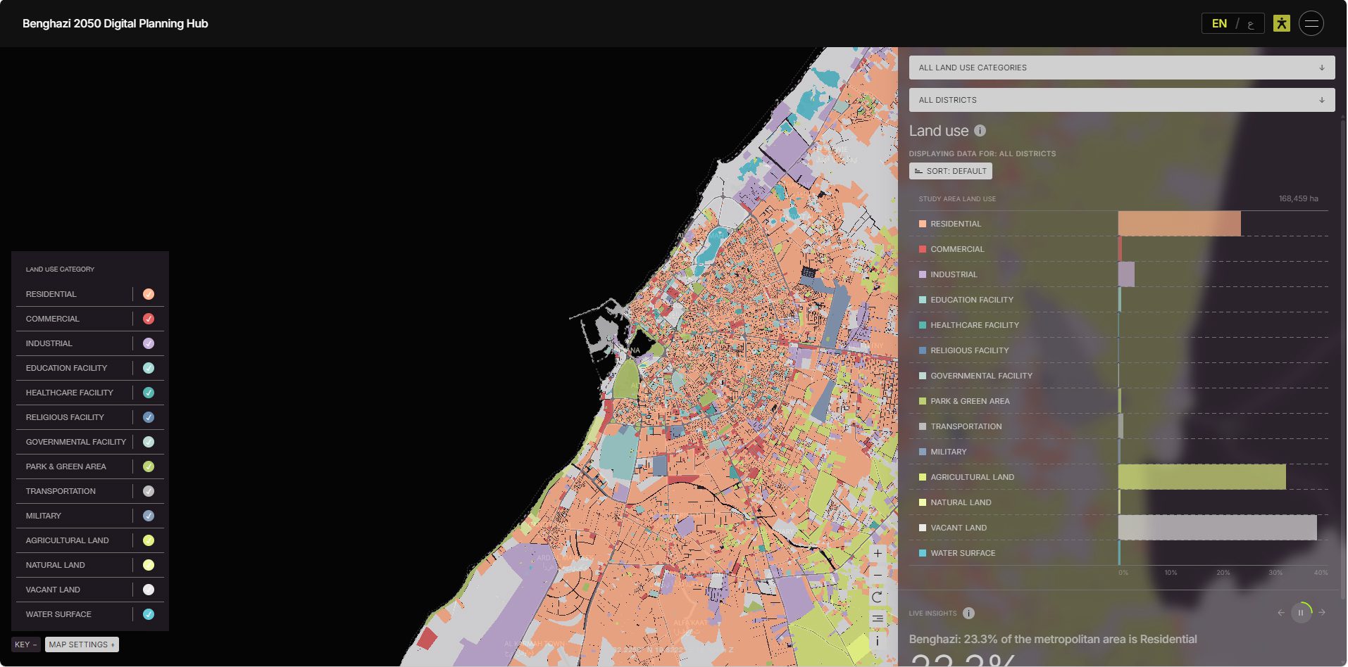
Consortium baseline study dashboard. Land use. Image © Prior+Partners
The Benghazi 2050 city plan arrives alongside other large-scale urban projects taking shape worldwide. UNStudio has designed a river-oriented masterplan that turns a former industrial site into a mixed-use district, reconnecting Cluj-Napoca with its waterfront in Romania. MVRDV and OODA revealed a masterplan for a vacant 28-hectare site between Marvila and Beato on Lisbon’s riverfront, which the Lisbon City Council recently approved.
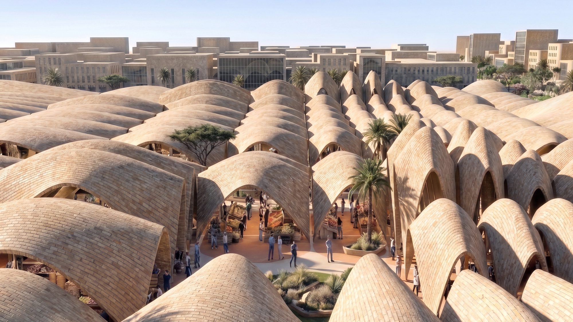
Benghazi 2050: Vision and Digital Planning Hub. Old Town. Image Courtesy of ZHA
A further comparison comes from Budapest, where a team led by French practice Coldefy won a competition to design a masterplan for Rákosrendező. That team, which included CITYFÖRSTER, Sporaarchitects, TREIBHAUS.LAND, and Marko & Placemakers, outlined a 15-year scheme to transform a brownfield site long regarded as the city’s “rust belt.” Each of these projects, like Benghazi’s, treats a neglected or growing urban edge as ground for coordinated renewal.
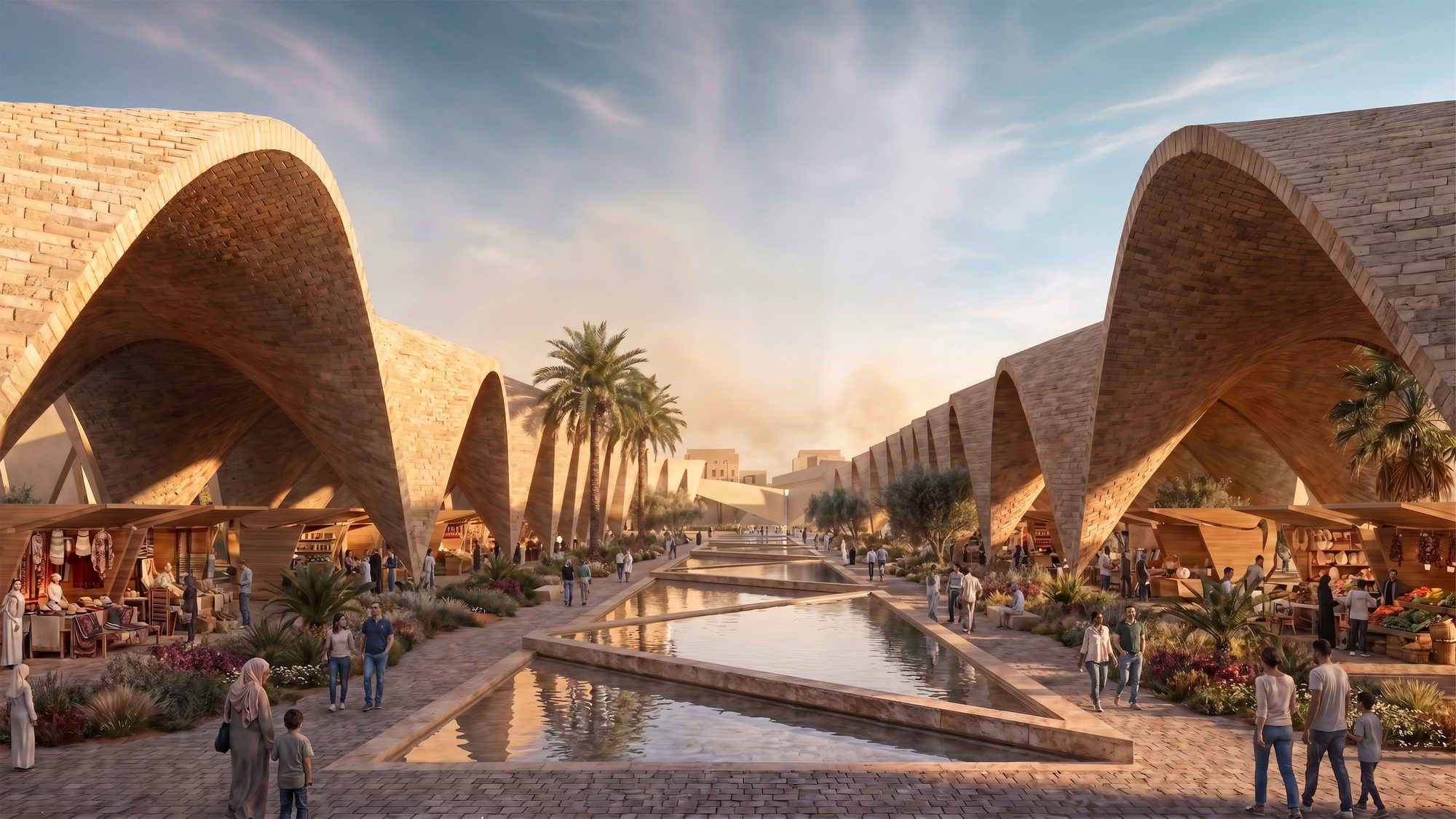
Benghazi 2050: Vision and Digital Planning Hub. Old Town. Image Courtesy of ZHA
The Benghazi proposal remains a concept at this stage, so its value lies in the framework and data model it sets out. Because the Digital Planning Hub is built to grow into a digital twin, it gives the city a tool to test proposals before they are built. The team offers that combined vision and evidence base as the first step toward the Next Generation City Plan.
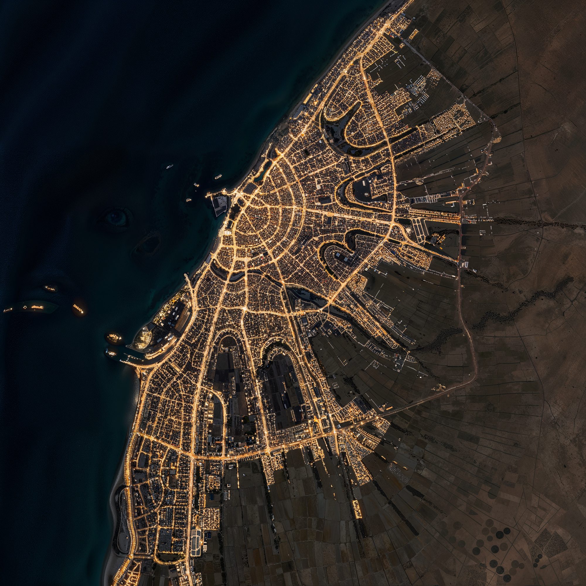
Benghazi 2050: Vision and Digital Planning Hub. Old Town. Image Courtesy of ZHA
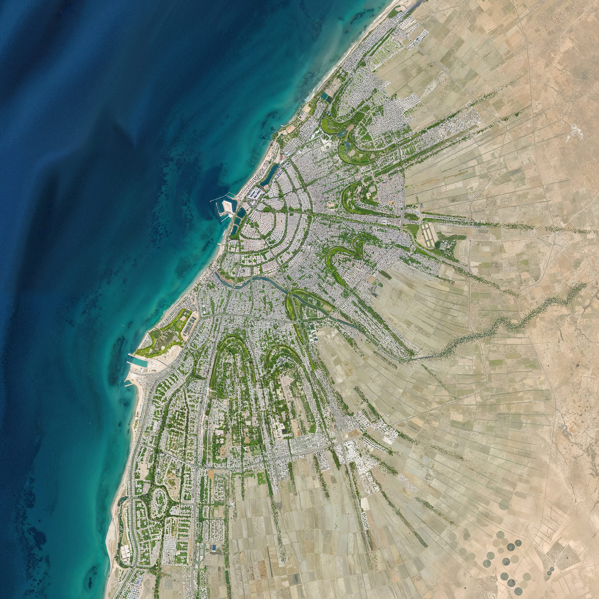
Benghazi 2050: Vision and Digital Planning Hub. Old Town. Image Courtesy of ZHA
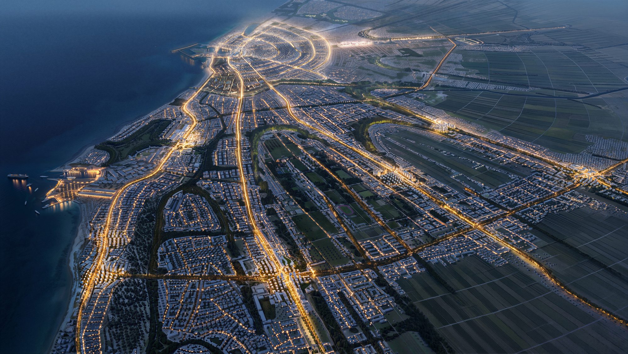
Benghazi 2050: Vision and Digital Planning Hub. Old Town. Image Courtesy of ZHA
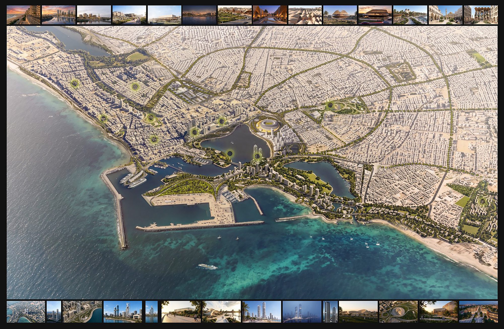
Benghazi 2050: Vision and Digital Planning Hub. Old Town. Image Courtesy of ZHA
Benghazi 2050: Vision and Digital Planning Hub. Old Town. Image Courtesy of ZHA
Benghazi 2050: Vision and Digital Planning Hub. Old Town. Image Courtesy of ZHA
Benghazi 2050: Vision and Digital Planning Hub. Old Town. Image Courtesy of ZHA
Benghazi 2050: Vision and Digital Planning Hub. Old Town. Image Courtesy of ZHA
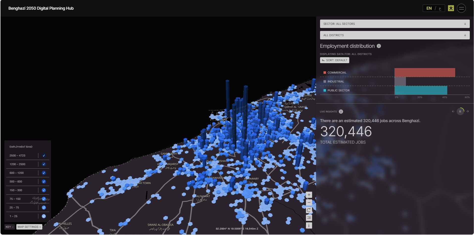
Benghazi 2050: Vision and Digital Planning Hub. Old Town. Image Courtesy of ZHA
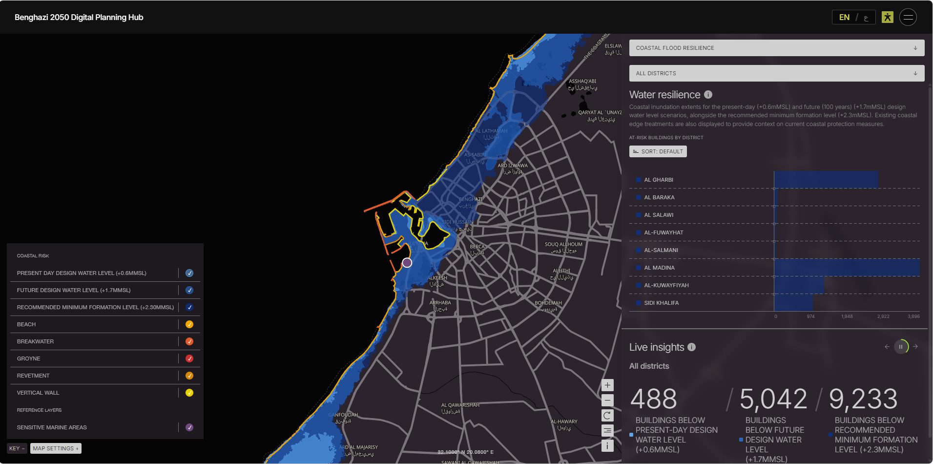
Benghazi 2050: Vision and Digital Planning Hub. Old Town. Image Courtesy of ZHA

Nora is an architect and editor with a degree from Pratt Institute. She bridges design practice and architectural criticism, documenting contemporary urban transformations through compelling visual narratives.