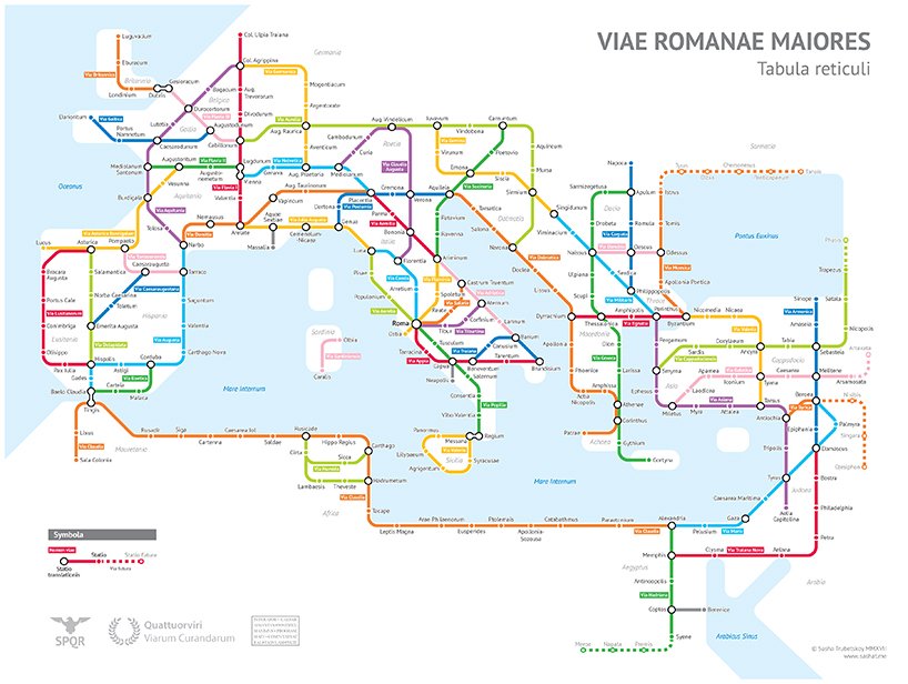
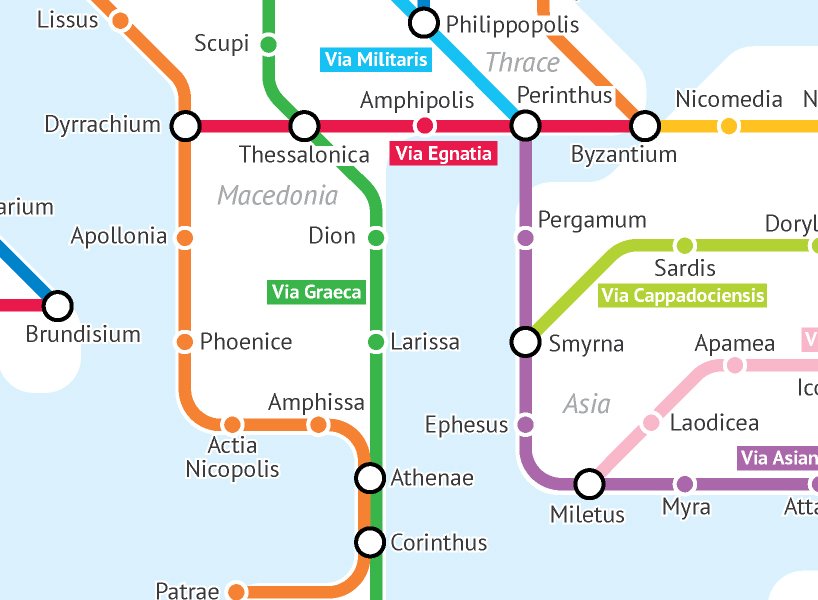
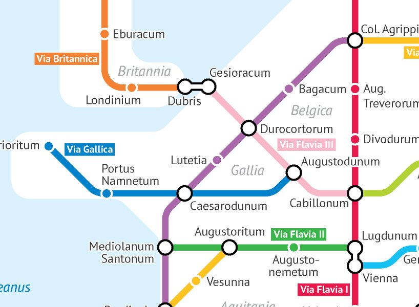
Sasha Trubetskoy is a student at the University of Chicago, majoring in statistics. He is originally from Washington D.C., and he describes himself as a “geography and data nerd.” He makes maps in his free time, inspired by the world around him. In his latest map, Trubetskoy illustrates ancient history via a contemporary colored transit map. He created a map of ancient Roman main streets and major roads in 125 AD, but in the form of subway lines.
Courtesy of Sasha Trubetskoy
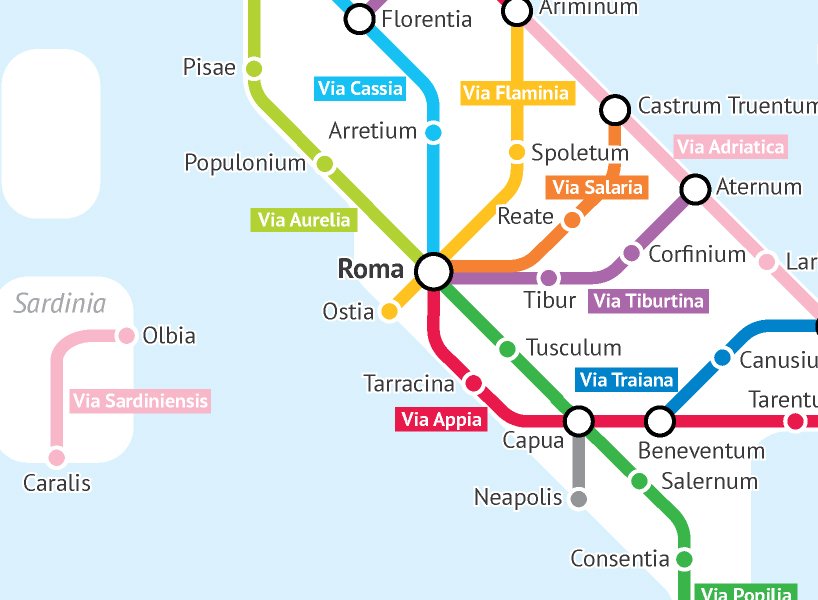
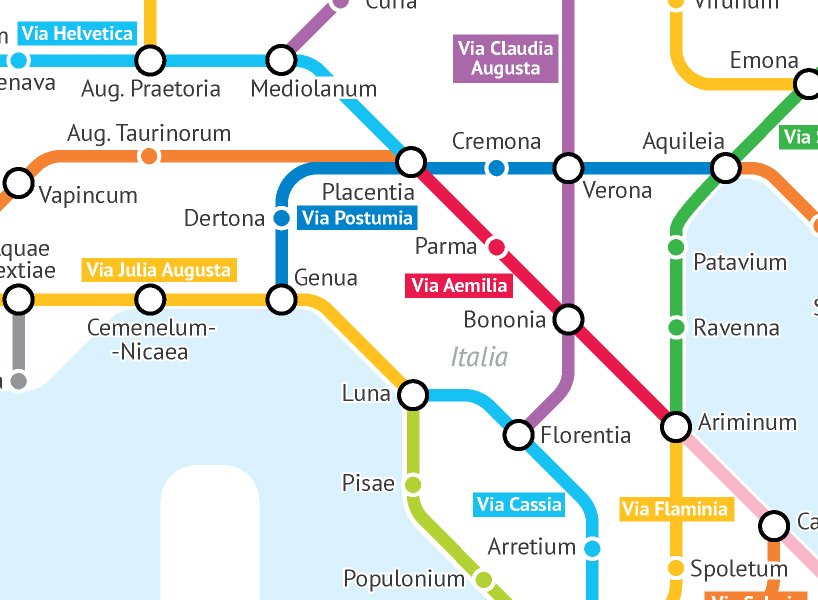
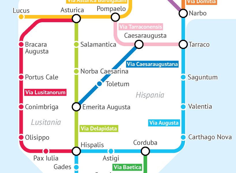
He generated his map based on information he found on Stanford’s ORBIS model, The Pelagios Project, and the Antonine Itinerary. Some of the roads on the map carry original names like Via Appia or Via Militaris, while other roads, with no historic titles, were named by Trubetskoy himself.
According to Trubetskoy and his map, a traveler in the summer would make it from Rome to Byzantium in two months, on foot, or in one month, on a horse. However, he revealed that travelers would normally combine road travel with sea travel which was “faster and cheaper.” He opted not to include the maritime routes in his map, to make it simpler.
Yosra is an architect, writer, and teacher. She is always into learning something new. Her life motto is: "A jack of all trades is a master of none, but oftentimes better than a master of one.” One day she will travel the world and visit its architectural wonders. In the meanwhile, she contends herself with reading and writing about them.